posted Oct 11, 2023
by KOA Corporation, A Lochner Company
The City of Pasadena's Bikeways Analysis and Feasibility Study builds on the outreach and feedback received during the development of the City's Bicycle Transportation Action Plan.

posted Apr 24, 2018
by Chuck Flink with Greenways Inc.
The ECG Alliance focuses on completing the long-distance system of trails and bike routes.
posted Jun 4, 2019
by Bill Long with Bay Area Ridge Trail Council, Frank Maguire, Diane Kripas
Learn how trail leaders are generating support through techniques like outings and events, hikes with landowners, improved mapping and compelling visual images and engage in a sharing of lessons learned.

posted Feb 19, 2018
Want your trail to connect to the next town? The next county? How about the next state?
posted Sep 30, 2020
This Statewide Trails Strategic Plan and the State Trails Program aim to ensure that program direction and efforts are consistent with other cooperators, funders, stakeholders, and ultimately service the expectations and needs of Colorado’s residents and visitors.
posted Aug 19, 2020
by Virginia Department of Transportation
VDOT developed this guide to aid the process of grassroots trail planning, based on the knowledge of experienced planners, research of best practices around the nation as well as the State, and the understanding gained from trail development process in the Town of Middleburg.
posted Jul 28, 2020
by Rails to Trails Conservancy
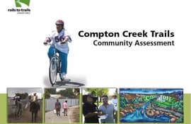
In 2009, Rails to Trails Conservancy (RTC) began a multi-year project to ensure that residents along the Compton Creek bike, equestrian and walking trails were involved in using and supporting their trails, as well as to provide opportunities for programs and activities.
posted Jul 27, 2020
by Rails to Trails Conservancy
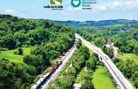
This feasibility study outlines the path forward and the potential in connecting Cleveland and Pittsburgh over 200+ miles of multi-use trails in Ohio, West Virginia and Pennsylvania. The alignment of the 200-miles-plus Cleveland to Pittsburgh (C2P) corridor is primarily made up of existing rail-trails, unused or abandoned rail corridors, and canal corridors.
posted Feb 19, 2018
by Christopher Douwes with Federal Highway Administration, Laura Toole with Federal Highway Administration
This presentation focuses on design publications that address common design challenges and barriers.
posted Jun 4, 2019
by Christopher Douwes with Federal Highway Administration
This presentation will provide a broad overview of Federal Highway Administration goals, programs, resources, and funding.
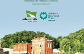
posted Jul 27, 2020
by Rails to Trails Conservancy
This study focuses on the segment of the P2P corridor that lies within the state of West Virginia, from Parkersburg to the West Virginia–Pennsylvania border, just north of Morgantown. The primary alignment of the P2P corridor utilizes existing rail-trails and unused or abandoned rail corridors, and was largely determined through the collaborative efforts of P2P corridor partners. The size and scope of this project produce inherent complexities that will take many partners—working in coordination over several years—to complete.
posted Jan 24, 2018
The Goethe Trail is part of Florida's Greenways and Trails System which is a combination of Federal, state, local and privately owned lands. While each parcel is unique, they collectively help to preserve and protect Florida's natural, cultural and historic resources.


