In 2009, Rails to Trails Conservancy (RTC) began a multi-year project to ensure that residents along the Compton Creek bike, equestrian and walking trails were involved in using and supporting their trails, as well as to provide opportunities for programs and activities.
by Rails to Trails Conservancy
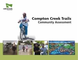
The Compton Creek bike path and multi-use trail (hereafter, “Trail” where referenced together) passes through the urban residential neighborhoods along the northern stretch of channelized Compton Creek for 2.85 miles, with the bike path following the east side and the multi-use trail on the west side of the channel. A separate 1.82-mile section of bike path runs through the industrial area south of the Artesia Freeway to Del Amo in unincorporated Los Angeles County. While these trail segments are already in place, there are opportunities to extend and connect the segments to each other as well as other regional pathways along the Los Angeles River. The trail system has additional potential for improvements in connections and awareness with the surrounding neighborhoods.
The recent Compton Creek Regional Garden Park Master Plan effectively lays out a vision and design for transformation of the corridor into a greenway with adjacent pocket parks and recreational amenities, as well as improved connections to the surrounding neighborhoods. The Garden Park Master Plan provides great detail regarding implementation tasks for infrastructure and programming. This Report provides an assessment of the current status of the Trail and the connections into the surrounding neighborhoods, as well as the important health linkages the Trail can provide to adjacent neighborhoods. The focus is on the northern segment of the trail that lies within the city of Compton.
Attached document published March 2011
Rails to Trails Conservancy (RTC) is a nonprofit organization dedicated to creating a nationwide network of trails from former rail lines and connecting corridors to build healthier places for healthier people.
RTC’s mission, and its value, is magnified in urban areas, where one mile of trail can completely redefine the livability of a community. Where trails are more than just recreational amenities, creating opportunities for active transportation and physical activity—improving our health and wellbeing—as they safely connect us to jobs, schools, businesses, parks, and cultural institutions in our own neighborhoods and beyond.
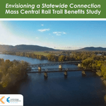
Envisioning a Statewide Connection Mass Central Rail Trail Benefits Study
posted Jun 14, 2023
Study shows completion of the Massachusetts Central Rail Trail System would bring significant health and economic benefits to the commonwealth.
posted May 15, 2023
Mountain Bike Trail Development: Guidelines for Successfully Managing the Process,” a 242-page “how to” manual covers modern trail development from trail types, to landscape analysis and design, to environmental and construction considerations, cost implications and more.
The Beerline Trail Equitable Implementation Plan – 2019
posted Sep 21, 2021
The Beerline Trail Neighborhood Development Project was created to ensure the next phases of trail development serve the needs of the community.
Planning and Managing Environmentally Friendly Mountain Bike Trails
posted Dec 22, 2020
This guidebook can be used to assist in successfully planning, designing, and constructing mountain bike trail systems, while keeping in mind that user issues must be addressed at every stage of development.
234 views • posted 07/28/2020