This study focuses on the segment of the P2P corridor that lies within the state of West Virginia, from Parkersburg to the West Virginia–Pennsylvania border, just north of Morgantown. The primary alignment of the P2P corridor utilizes existing rail-trails and unused or abandoned rail corridors, and was largely determined through the collaborative efforts of P2P corridor partners. The size and scope of this project produce inherent complexities that will take many partners—working in coordination over several years—to complete.
by Rails to Trails Conservancy
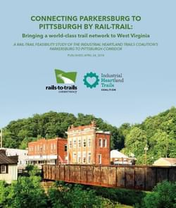
No matter what the subject, feasibility studies pose an inherent question: is this project realistic and possible? In this instance, the question becomes: is it possible to develop the P2P corridor as a seamlessly connected rail-trail? RTC’s answer, backed by decades of rail-trail experience, is a resounding YES! Acquiring gap segments, designing and constructing the trail, then maintaining, promoting and connecting the trail to nearby communities will not come without challenges. Continued coordination among the strong partners that make up the P2P Corridor Working Group, along with support from state agencies, local elected officials, decision-makers, and—most importantly— community members from along the corridor, will be at the core of this project’s success. In reflecting on the totality of the P2P feasibility, several observations present themselves.
Attached document published April 2018
Rails to Trails Conservancy (RTC) is a nonprofit organization dedicated to creating a nationwide network of trails from former rail lines and connecting corridors to build healthier places for healthier people.
RTC’s mission, and its value, is magnified in urban areas, where one mile of trail can completely redefine the livability of a community. Where trails are more than just recreational amenities, creating opportunities for active transportation and physical activity—improving our health and wellbeing—as they safely connect us to jobs, schools, businesses, parks, and cultural institutions in our own neighborhoods and beyond.
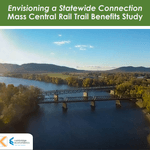
Envisioning a Statewide Connection Mass Central Rail Trail Benefits Study
posted Jun 14, 2023
Study shows completion of the Massachusetts Central Rail Trail System would bring significant health and economic benefits to the commonwealth.
posted May 15, 2023
Mountain Bike Trail Development: Guidelines for Successfully Managing the Process,” a 242-page “how to” manual covers modern trail development from trail types, to landscape analysis and design, to environmental and construction considerations, cost implications and more.
The Beerline Trail Equitable Implementation Plan – 2019
posted Sep 21, 2021
The Beerline Trail Neighborhood Development Project was created to ensure the next phases of trail development serve the needs of the community.
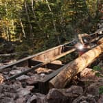
Planning and Managing Environmentally Friendly Mountain Bike Trails
posted Dec 22, 2020
This guidebook can be used to assist in successfully planning, designing, and constructing mountain bike trail systems, while keeping in mind that user issues must be addressed at every stage of development.
209 views • posted 07/27/2020