VDOT developed this guide to aid the process of grassroots trail planning, based on the knowledge of experienced planners, research of best practices around the nation as well as the State, and the understanding gained from trail development process in the Town of Middleburg.
by Virginia Department of Transportation
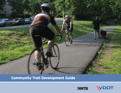
The term “trails” is often used to describe a variety of paved and unpaved pedestrian and bike facilities, ranging from informal recreational networks serving mountain bikers and hikers to formal AASHTO specified facilities providing vital transportation connections within a community.
This guidebook focuses on shared-use paths, an important ingredient in the transportation system’s multi-modal network. Shared-use paths (referred to as “trails” throughout this document) provide pedestrians and bicyclists, access to activity centers such as schools, libraries, town centers, parks, businesses, employment centers and recreational facilities. A well planned trail may offer opportunities for several markets: a safe route to school for children, bicycle commuters, neighborhood recreational activities, and competitive runners.
A shared-use path is one of the five facilities to accommodate bicycling; others include on-street bicycle lanes, designated roadway shoulders, a wide outside travel lane designed and signed for bicycle use, and a signed shared use residential street. There are many types of trail surfaces, each tailored to the users and providing a unique experience
Attached document published February 2012
The Virginia Department of Transportation (VDOT) is responsible for building, maintaining and operating the state's roads, bridges and tunnels.
And, through the Commonwealth Transportation Board, it provides funding for airports, seaports, rail and public transportation.
Virginia has the third-largest state-maintained highway system in the country, behind Texas and North Carolina.
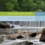
Blackstone River Bikeway (2017)
posted Apr 19, 2024
The Blackstone River Bikeway is a 48-mile-long route connecting Worcester, Massachusetts with Providence, Rhode Island. The Bikeway generally follows the historic Blackstone River and utilizes an off-road multi-use path and an on-road facility.
posted Apr 17, 2024
This report summarizes guidance and best practices to create safer bicycle facilities and connect them into networks that allow more people to safely bike to more places within and throughout communities.
Wilderness Stewardship Plan Handbook
posted Mar 27, 2024
The purpose of the Wilderness Stewardship Plan Handbook 2014 is to provide direction for creating wilderness stewardship plans, driven by the concept of preserving wilderness character. The Handbook focuses on how to incorporate wilderness policy and wilderness character into a wilderness stewardship plan and also offers a general overview of planning and compliance to be useful for those with and without a professional background in planning.
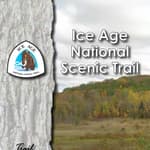
Ice Age National Scenic Trail: Trail Stewardship Notebook
posted Mar 27, 2024
The Ice Age National Scenic Trail (NST) is a thousand-mile footpath highlighting Wisconsin’s renowned Ice Age heritage and scenic beauty. The Ice Age Trail Alliance (IATA) and its partners can shape users’ experiences. As stewards of the land and the Trail, we can help users develop a connection with the land and create a sense of wonder — even pique their curiosity enough to further explore the Trail.
404 views • posted 08/19/2020