Presented at the 15th National Trails Symposium, Redding, California, September 21-24, 2000
The Goethe Trail is part of Florida's Greenways and Trails System which is a combination of Federal, state, local and privately owned lands. While each parcel is unique, they collectively help to preserve and protect Florida's natural, cultural and historic resources.
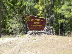
The 118-mile Goethe Trail System has three trailheads. The trailheads, located 10 miles apart, allow for dispersed use, and minimize impact in any one location. The number of trail users at a trailhead is self-limiting to the size of the parking lot.
This system is for shared-use to minimize "turf" conflicts and to encourage interaction among forest visitors. This currently includes hikers, bikers, carriage drivers, and horseback riders. The trails follow old roads that were historically used during the early part of the 20th Century to harvest resin the longleaf pine trees for the naval stores industry. Many trees still show the "cat face" scars on the boles.
Logging ramps were reclaimed and stabilized for the three trailheads. No new disturbances were made for the trail system. The trails are marked going one-way to provide an added level of safety, to lessen the costs of signage and to lessen the labor involved in marking.
Aluminum diamonds, 4" square, are used to mark the trails. This does not conflict with standard forestry practices of timber marking or endangered species identification or boundary marking... which all may use colored paint on the trees. The diamonds themselves are scraps donated by a local horse trailer manufacturer and are recycled and used as markers. The diamonds are nailed to trees with 1Q" aluminum nails. The markers are left loose to allow for tree growth and swelling. The nails are purchased from hardware suppliers for $9.00 per 1.5#. The aluminum sheets are 4x10', and yield 360 markers. The sheets, if purchased, would cost $50, making the markers <14 cents. They are then spray- painted in colors that show up the best. Some colors that are used successfully here are orange, red, pink, yellow, purple, green, and blue. Solid white can be used if the overview map is not in color. To enhance visibility, an outline or stencil effect is used that leaves a border of white that shows up from a distance.
Double diamonds indicate a change of direction and are placed one above another. All markers are on the right side of the trail for consistency, just like on public roads. Wooden signs are nailed to trees with the same size nails. They are painted brown and the lettering is painted yellow. They may be routed. Pressure treated 1x6 boards are cut to size. These boards were scraps also. Directional arrows are placed before the turns. Written information is placed at crucial intersections..."road crossing," "to trailhead." This gives the visitor added assurance and serves as confidence markers. For added confidence, reference letters are put on the diamonds at prominent intersections. These A, B, Cs help to pinpoint a location. This is useful for emergencies or to describe forest conditions (prescribed fire, dead fall, litter, etc.)
Distances range from 2.5 to 15 miles in length. Signs are put in one-mile increments at the last five miles of all trails telling the user how many "miles to go." A loop is a short cut through a main trail. A connector trail takes you from one colored trail to another and may have both colors on the diamond. All trails start and stop at the trailhead. Long distance runners, cyclists, and equestrians like to combine trails for special events and competitions.
The colored overview map is inside the kiosk. The trail user gets a black and white version of the colored map, with the colors being replaced by graphic symbols, (*** yellow trail, +++ red loop, xxx green trail). This map has mileage and other regulatory information. This is a cost-effective substitute to full color copies. The kiosk has other information that is useful to the visitor such as hunting dates, special events, trail incentives and environmental education. Parking space, trailhead features and trail construction were done using the GUIDELINES recommended by the Florida Recreational Trails Council.
The staff Biologist and trail volunteers work closely to insure that flora and fauna are protected and BEST MANAGEMENT PRACTICES are followed. The Water Management District is consulted and where appropriate, permits are issued for the application of soil stabilization fabrics that are used at low water crossings. Trail volunteers are welcomed attendees at staff meetings and are kept up to date on timber sales and prescribed burns that may affect trail use.
Forest Awareness Week and National Trails Day recognize community involvement. Local corporate sponsors, user groups, volunteers and donations help plan, build and maintain the trails.
The Goethe Trail is part of Florida's Greenways and Trails System which is a combination of Federal, state, local and privately owned lands. While each parcel is unique, they collectively help to preserve and protect Florida's natural, cultural and historic resources.
Wilderness Stewardship Plan Handbook
posted Mar 27, 2024
The purpose of the Wilderness Stewardship Plan Handbook 2014 is to provide direction for creating wilderness stewardship plans, driven by the concept of preserving wilderness character. The Handbook focuses on how to incorporate wilderness policy and wilderness character into a wilderness stewardship plan and also offers a general overview of planning and compliance to be useful for those with and without a professional background in planning.
Ice Age National Scenic Trail: Trail Stewardship Notebook
posted Mar 27, 2024
The Ice Age National Scenic Trail (NST) is a thousand-mile footpath highlighting Wisconsin’s renowned Ice Age heritage and scenic beauty. The Ice Age Trail Alliance (IATA) and its partners can shape users’ experiences. As stewards of the land and the Trail, we can help users develop a connection with the land and create a sense of wonder — even pique their curiosity enough to further explore the Trail.
National Park Service − Rivers, Trails and Conservation Assistance Program
posted Mar 3, 2023
This publication is designed to inform the reader about the services provided by the National Park Service – Rivers, Trails and Conservation Assistance Program.
National Wildlife Refuge System Land Protection Project
posted Jul 29, 2020
The U.S. Fish and Wildlife Service, along with our partners, is charting a course for the future of the National Wildlife Refuge System.
731 views • posted 01/24/2018