When flood PLAIN turns into flood WAY, trails are in trouble.
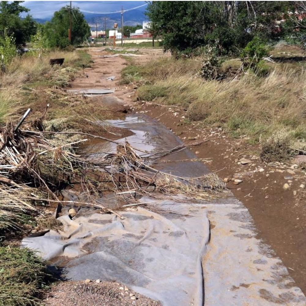
The recent floods in Colorado remind us that our stream-side corridors are vulnerable. Yet in our urban and suburban areas, trails along rivers are the most popular pathways. How do we balance the cost and value of our greenways when they’re covered in brown mud?
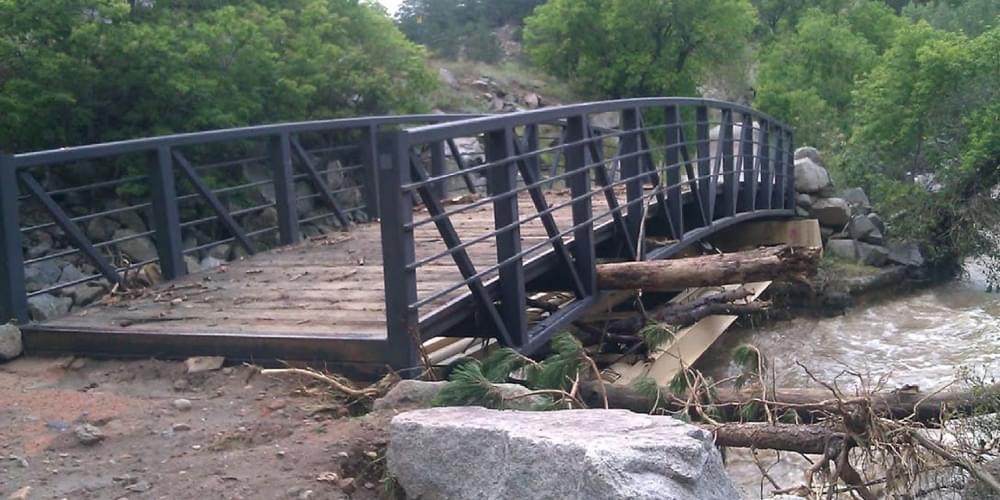
It’s clear that manufactured steel bridges can take a direct hit and still survive intact. They may have to be retrieved from some distance downstream, however. How about trail surfaces? Crushed rock is extremely erodible, and asphalt is also susceptible to running water damage.
Concrete can withstand being submerged, as we have seen from decades of annual spring flooding along Denver’s greenways. However, severe undercutting of stream banks can totally wipe out a concrete trail, and then you have big slabs of heavy debris to dispose of.
It’s pretty clear that homes don’t belong in flood plains, but what about trails? Birds, fish, and muskrats– as well as bikers, skaters, and hikers– all love our greenway corridors. Many plants, like willows and cottonwoods, sprout up eagerly after a flood. And as Boulder County Parks and Open Space says, “We WILL be back!”
— Stuart Macdonald
American Trails Magazine and website editor
Building a Permeable, Low Maintenance Recreational Trail Along a Shoreline
posted Apr 7, 2023
In 2009, the city of The Colony planned to build a recreational trail (10 foot-wide, 3.5 mile pathway) that would run along the lake’s shoreline, contouring to its natural shape and providing residents with a picturesque route for outdoor activities such as walking, jogging, and cycling. The city selected the GEOWEB® Soil Stabilization System due to its flexibility to conform to curves, surface permeability, and low maintenance design.
posted Jul 15, 2022
This research investigated the influence of several use-related, environmental, and managerial factors on soil loss on recreational trails and roads at Big South Fork National River and Recreation Area, a unit of the U.S. National Park Service.
All-Terrain Vehicle Sustainability Assessments
posted Jul 15, 2022
The sustainable management of ATV use is an expensive proposition requiring careful design, construction, and maintenance of ATV trails.
posted Jul 15, 2022
This research assessed the condition and sustainability of the trail system at Tallgrass Prairie National Preserve, a National Park Service unit that partners with The Nature Conservancy (TNC) in the management of this unit.
1,121 views • posted 09/28/2013