posted Jan 14, 2022
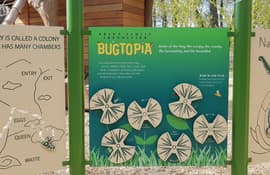
iZone Imaging’s High Pressure Laminate brings to life the interpretive signage throughout the Brawn Family Foundation Bugtopia Playground at the Calgary Zoo. The signs are eco-friendly and can withstand the high traffic interactive area over time. (Sponsored Content)
posted Jun 11, 2021
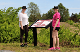
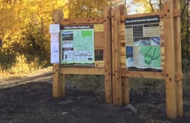
by Emily McKinney with Pannier Graphics
Pannier is the leading manufacturer of signs, panels, exhibit bases, and frames. With a full line of exhibit bases, there is a product for every trail and wayside application.
posted May 7, 2021
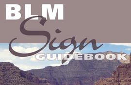
This National Sign Guidebook presents information for planning, designing, fabricating, procuring, installing, and maintaining signs in a clear, complete, and user friendly format.
posted May 6, 2021
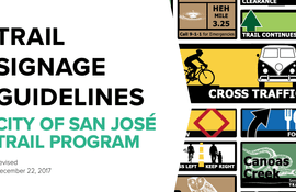
by City of San Jose - Parks, Recreation, and Neighborhood Services
The purpose of this document is to provide the required tools for trail planners, designers, and contractors to deploy a cohesive trail signage program throughout the City of San José’s Trail Network.

posted Feb 23, 2021
Westchester County New York and Friends of Westchester County Parks, in collaboration with Westchester County Parks, announce collaboration with Smart Outdoor to enhance 34.6-mile running trail.
posted Jan 8, 2021
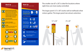
by Don Meeker with Terrabilt Wayfinding Solutions
Don Meeker, president of Terrabilt, reflects on trails as a critical sanctuary during COVID-19, and provides guidance on signage to keep everyone on trails safe. Terrabilt will also provide the production artwork for their COVID-19 trail sign for free.
posted Nov 23, 2020
by Gwinnett County Department of Community Services
Gwinnett County is currently the second most populous county in Georgia with more than 936,000 residents and also has a minority-majority population. By 2050, estimates project Gwinnett could grow to as many as 1.5 million residents, making it the most populated county in the state.
posted Oct 7, 2020
From wayfinding signage that help the public navigate your trail, to informational signs that educate trail visitors about the area, promote conservation, and create a more interactive experience, proper signage can take trails to the next level.

posted Aug 19, 2020
by Michigan Department of Natural Resources, Parks and Recreation Division
The purpose of this plan is to help communities and stakeholders incorporate heritage on the lower reach of the nationally designated Huron River Water Trail (HRWT), from Flat Rock to Lake Erie, which will create a more meaningful trail experience and a greater sense of place.

posted Aug 19, 2020
This toolkit was designed to assist managers in developing and implementing regional or site-specific interpretive plans. It describes each step in the process from the early planning stages through implementation to evaluation.
posted Aug 19, 2020
The Continental Divide National Scenic Trail (CDNST) Interpretive Plan guides the development and implementation of information, orientation and interpretation for the CDNST. Specifically, this plan includes interpretive goals, objectives, themes, exhibit recommendations, and design guidelines for interpretive efforts associated with the trail.
posted Aug 13, 2020
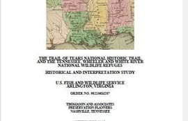
by U.S. Fish & Wildlife Service
The purpose of this study is to provide baseline historical information pertaining to those portions of the Trail of Tears National Historic Trail that cross onto lands managed by the FWS at the White River National Wildlife Refuge (NWR) in Arkansas, the Wheeler NWR in Alabama, and the Tennessee NWR in Tennessee.


