
posted Aug 19, 2020
The Bay Trail Project is a nonprofit organization administered by the Association of Bay Area Governments (ABAG) that plans, promotes and advocates for the implementation of a continuous 500-mile bicycling and hiking path around San Francisco Bay. Two of the most commonly asked questions regarding the Bay Trail: “When will it be done?” and “How much will it cost?”

posted Aug 19, 2020
This report focuses on the issues surrounding the proposed development of the Palouse to Cascades Rail-Trail.
posted Aug 19, 2020
by Massachusetts Department of Conservation and Recreation
The DCR’s Trails Program seeks to provide a safe, quality recreation experience for a diverse range of trail users while practicing sound stewardship of the Commonwealth’s natural and cultural resources. This “Trails Guidelines and Best Practices Manual” meets this responsibility by providing a consistent set of trail management policies, guidelines, procedures, and best practices in sustainable trail development.
posted Aug 19, 2020
by Michigan Department of Natural Resources, Parks and Recreation Division
The purpose of this plan is to help communities and stakeholders incorporate heritage on the lower reach of the nationally designated Huron River Water Trail (HRWT), from Flat Rock to Lake Erie, which will create a more meaningful trail experience and a greater sense of place.
posted Aug 19, 2020
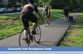
by Virginia Department of Transportation
VDOT developed this guide to aid the process of grassroots trail planning, based on the knowledge of experienced planners, research of best practices around the nation as well as the State, and the understanding gained from trail development process in the Town of Middleburg.
posted Aug 19, 2020
The Captain John Smith Chesapeake National Historic Trail joined the National Trails System following designation by Congress in 2006. The trail helps visitors experience, envision, understand, and protect what the explorers and inhabitants of the region encountered 400 years ago.

posted Aug 19, 2020
This toolkit was designed to assist managers in developing and implementing regional or site-specific interpretive plans. It describes each step in the process from the early planning stages through implementation to evaluation.
posted Aug 19, 2020
In order to achieve the objective of establishing a continuous trail of the magnitude and quality of the CDNST, it is necessary to establish a formal process for integrating the CDNST requirements into the long-range land and resource management programs of the various Federal and State agencies. Such a process should be both faithful to the intentions and requirements of the National Trails System Act and compatible with the regulations and procedures under which the agencies must work.
posted Aug 19, 2020
The Continental Divide National Scenic Trail (CDNST) Interpretive Plan guides the development and implementation of information, orientation and interpretation for the CDNST. Specifically, this plan includes interpretive goals, objectives, themes, exhibit recommendations, and design guidelines for interpretive efforts associated with the trail.
posted Aug 13, 2020
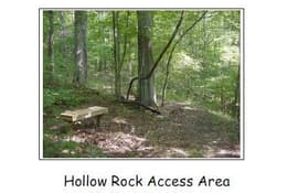
The planned Hollow Rock Access Area is a multi-jurisdictional project to conserve significant natural and cultural resource lands along New Hope Creek and to make portions of the site available for low-impact recreational uses.
posted Aug 13, 2020
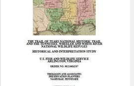
by U.S. Fish & Wildlife Service
The purpose of this study is to provide baseline historical information pertaining to those portions of the Trail of Tears National Historic Trail that cross onto lands managed by the FWS at the White River National Wildlife Refuge (NWR) in Arkansas, the Wheeler NWR in Alabama, and the Tennessee NWR in Tennessee.
posted Aug 6, 2020
by Federal Highway Administration
The 2016-2021 Strategic Agenda for Pedestrian and Bicycle Transportation builds on 25 years of progress toward increasing walking and biking safety and activity throughout the United States. The 1994 National Bicycling and Walking Study: Transportation Choices for Changing America set the stage for advancing safe, accessible, comfortable, and well-used pedestrian and bicycle transportation networks, with a focus on increasing trips and reducing injuries and fatalities.


