The planned Hollow Rock Access Area is a multi-jurisdictional project to conserve significant natural and cultural resource lands along New Hope Creek and to make portions of the site available for low-impact recreational uses.
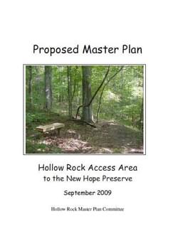
The New Hope Corridor Open Space Master Plan was adopted in 1991 by the City of Durham, Durham County, Orange County, and the Town of Chapel Hill. The plan called for the protection of an open space corridor along New Hope Creek and its tributary streams for recreational trails and conserving wildlife habitat. The plan identified 10 components—one of which was the “Hollow Rock Access Area.”
The Hollow Rock Access Area is intended as a community low-impact recreational area, with facilities and amenities that blend with the natural setting. The site is envisioned as a gathering place for picnics and forest walks, and for people of all ages to learn about the rich natural heritage and remarkable history of land use in the Hollow Rock community.
The site is also envisioned as an important gateway to the regional New Hope Creek trail system. Land protection along the New Hope Creek corridor extends well beyond the boundaries of the Hollow Rock Access, with 1,900 acres of the Duke Forest (Korstian Division) north of Erwin Road, and Orange and Durham counties owning over 260 acres of additional conservation land downstream of the Hollow Rock area, forming a nearly continuous corridor of open space south to Jordan Lake.
In 2006 the four local governments signed an interlocal agreement for the planning and operation of the Hollow Rock Access Area portion of the New Hope Creek master plan. The agreement also established the advisory Committee to develop a master plan for the property. A Hollow Rock master plan committee was appointed in late 2006 and charged with developing recommendations for the types and location of facilities for the site.
Attached document published September 2009
Alaska’s Statewide Comprehensive Outdoor Recreation Plan (SCORP) 2023-2027
posted Oct 16, 2023
Outdoor recreation is vital to the lives and livelihoods of Alaskans. The state’s stunning wild landscapes, vast expanses of public land, productive ecosystems, vital cultural traditions, and four seasons of outdoor adventure position Alaska to be a world leader in outdoor recreation.
Gwinnett Countywide Trails Master Plan
posted Aug 16, 2023
Gwinnett County is currently the second most populous county in Georgia with more than 936,000 residents and also has a minority-majority population. By 2050, estimates project Gwinnett could grow to as many as 1.5 million residents, making it the most populated county in the state.
Top 10 Requests for Trails and Outdoor Recreation Master Plans
posted Apr 2, 2023
Tony Boone and Jon Altschuld are both Board Members of the Professional TrailBuilders Association (PTBA), and both will be presenting at the 2023 American Trails/PTBA International Trails Summit. Their companies, Tony Boone Trails, and Chinook Landscape Architecture are Sierra-level sponsors for the conference.
Sun Corridor Trail Alliance Action Plan
posted Sep 29, 2021
The SCTA Action Plan serves as a checklist of guiding tasks for the new organization as it continues to move the Sun Corridor Trail forward.
236 views • posted 08/13/2020