posted Apr 11, 2018
The 750-mile trail will provide new opportunities for hiking and biking along scenic vistas and through charming, historic communities, driving tourism and economic activity across New York.
posted Aug 16, 2023
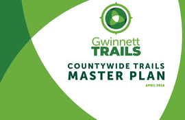
by Gwinnett County Department of Community Services
Gwinnett County is currently the second most populous county in Georgia with more than 936,000 residents and also has a minority-majority population. By 2050, estimates project Gwinnett could grow to as many as 1.5 million residents, making it the most populated county in the state.
posted Jul 23, 2020
by Federal Highway Administration
This document highlights case studies of projects that contribute to safe and connected pedestrian and bicycle networks in States and communities throughout the U.S., while at the same time providing resiliency and green infrastructure benefits that promote resiliency and relieve burdens on stormwater systems.

posted Jul 30, 2020
The Sheepskin Trail, a rail-trail project is a proposed 34 mile bicycle/pedestrian path that will extend from Dunbar Township to Point Marion Borough at the Pennsylvania/West Virginia state line. The intent of this study update is to utilize and update the 1999 Feasibility Study as necessary based on changes to the trail corridor that have occurred in the past 18 years.
posted Jul 23, 2020
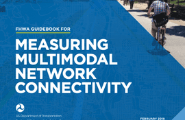
by Federal Highway Administration
The Guidebook for Measuring Multimodal Network Connectivity is a guide for transportation planners and analysts on the application of analysis methods and measures to support transportation planning and programming decisions. It describes a five-step analysis process and numerous methods and measures to support a variety of planning decisions. It includes references and illustrations of current practices, including materials from five case studies conducted as part of the research process.

posted Jan 24, 2018
by R. Brian Kermeen with USDA Forest Service
Like most areas managed by the Forest Service, U.S. Department of Agriculture, the central Sierra Nevada has steep and mountainous terrain. Most of our facilities evolved over time or were designed 30 years ago with no consideration for the needs of persons with disabilities.
posted Jan 19, 2018
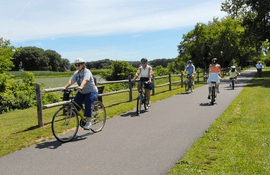
San Bernardino County finds trails are an essential part of healthy communities.
posted Jan 19, 2018
by Randy Martin with Trailscape
With the emphasis on health and fitness in today's society, trails are becoming just as important as streets and sidewalks in our communities.

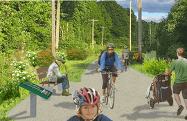
posted Jan 4, 2018
by Randy Martin with Trailscape
Designers and land managers should consider the benefits of lengthening trails to lower the average grade while at the same time including short sections that are much steeper.
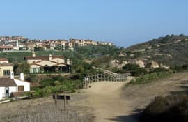
posted Nov 5, 2018
The Albany-Hudson Electric Trail is an important part of the Empire State Trail, providing a key link between the Capital Region and the Mid-Hudson Valley. Since the trail is being developed along electrical utility lines, this plan incorporates design guidelines addressing safety and operational concerns.
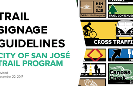
posted May 6, 2021
by City of San Jose - Parks, Recreation, and Neighborhood Services
The purpose of this document is to provide the required tools for trail planners, designers, and contractors to deploy a cohesive trail signage program throughout the City of San José’s Trail Network.

posted Aug 19, 2020
by Michigan Department of Natural Resources, Parks and Recreation Division
The purpose of this plan is to help communities and stakeholders incorporate heritage on the lower reach of the nationally designated Huron River Water Trail (HRWT), from Flat Rock to Lake Erie, which will create a more meaningful trail experience and a greater sense of place.


