Defining a trail corridor in law, policy, and planning.
The National Recreation Trails Program defines a trail as, "A trail is a travel way established either through construction or use and is passable by at least one or more of the following, including but not limited to: foot traffic, stock, watercraft, bicycles, in-line skates, wheelchairs, cross-country skis, off-road recreation vehicles such as motorcycles, snowmobiles, ATVs and 4-wheel drive vehicles."
23 U.S.C. 206:
§ 206. Recreational trails program
(a) DEFINITIONS.—In this section, the following definitions apply:
(1) MOTORIZED RECREATION.—The term ‘motorized recreation’ means off-road recreation using any motor-powered vehicle, except for a motorized wheelchair.
(2) RECREATIONAL TRAIL.—The term ‘recreational trail’ means a thoroughfare or track across land or snow, used for recreational purposes such as—
(A) pedestrian activities, including wheelchair use;
(B) skating or skateboarding;
(C) equestrian activities, including carriage driving;
(D) nonmotorized snow trail activities, including skiing;
(E) bicycling or use of other human-powered vehicles;
(F) aquatic or water activities; and
(G) motorized vehicular activities, including all-terrain vehicle riding, motorcycling, snowmobiling, use of off-road light trucks, or use of other off-road motorized vehicles.
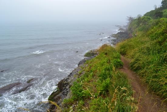
The trail corridor is a zone that includes the trail tread and the area above and to the sides of it. Trail standards typically define the edges of this area as the "clearing limits." Vegetation and other obstacles, such as boulders, are trimmed back or removed from this area to make it possible to ride or walk on the tread (figure 5).
The dimensions of the corridor are determined by the needs of the target user and trail difficulty level. For example, in the Northern Rockies, trail corridors for traditional packstock are cleared 2.5 m (8 ft) wide and 3 m (10 ft) high. Hiker trails are cleared 2 m (6 ft) wide and 2.5 m (8 ft) high. Check with your local trail manager to determine the appropriate dimensions for each of your trails.
Trail corridor means the recreational trail plus a scenic or recreational easement, if such easement is acquired as a part of the recreational trail and if it is essential to the recreational experience of the trail user.
Researching a railroad right-of-way, or corridor, is a good place to begin when assessing its potential for trail development. The first step in your search is to determine the corridor status—does the Surface Transportation Board recognize the corridor as "active" or "abandoned?" Identifying the corridor status will help you decide on a suitable course of action for acquisition.
Trail Type
Is the fundamental trail category (only one per trail segment) that indicates the predominant trail surface or trail foundation, and the general mode of travel.
Four fundamental trail types within DCR include:
Illustrations of trail corridors, and the influence of use, environmental, and managerial factors on the width of recreational trails.
Chuck Flink, author and expert on Greenways, has helpfully defined what constitutes a Greenway. "Greenways are corridors of land recognized for their ability to connect people and places together. These ribbons of open space are located within linear corridors that are either natural, such as rivers and streams, or manmade, such as abandoned railroad beds and utility corridors."
National Historic Trails differ from "regular" trails, which can generally be described, inventoried, and managed as one linear route. This is not usually the case with
NHTs. To better understand the inventory and management of NHTs, it is helpful to consider each NHT as an unofficial, informal "corridor", rather than a single line on a map. Each “NHT corridor” is comprised of two and often three aspects:
Designated Route: What and where is the congressionally designated NHT route and associated NHT heritage sites?
Heritage Resources: What and where is the route and sites where history actually occurred?
Recreation and/or Interpretive Trail/Road/Sites: Where/what is the route and associated sites that people can use (i.e. trail/road/site used for recreation
or interpretation)?
To be effective, NHT administrators and managers rely on data representing two to three of these various components that can occur within an NHT corridor. It is important to note that “corridor” is used here as an unofficial descriptive concept and not intended to imply the existence of actual area boundaries.
The Federal NHT Data Standards Team recommends this concept be adopted and used internally to better communicate and explain the management and data needs related to NHTs.
Dave Getchell wrote in a 2006 River Network newsletter, "Water trails are rocky seacoasts, a wooded river-bend, sandy shorelines, a quiet marsh and a busy harbor. They are recreational waterways between specific locations containing access points and day use sites. They are launch ramps and overnight campsites. They are boats and paddles and cameras and field guides. Water trails are blue ribbons following the wayside sights and sounds of people and nature throughout the continent, with diverse users enjoying this network of liquid pathways from sea to shining sea and from tropic gulf to icy fjord.
But water trails are more than a geographical phenomenon; they are alive. They are animated by the pursuits of their builders and their users. Water trails connect people with places and simultaneously enrich and protect both. By identifying and interpreting places, both natural and constructed, the water trail brings the user into contact with the whole ecology of the corridor."
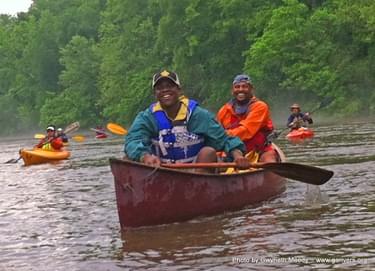
A water trail is a designated route along a lake, river, canal or bay specifically designed for people using small boats like kayaks, canoes, single sailboats or rowboats. The trails, sometimes called “blueways,” are the aquatic equivalent of a hiking trail (or “greenway”). Water trails feature well-developed access and launch points; are near significant historical, environmental or cultural points of interest; and often include nearby amenities such as restaurants, hotels and campgrounds.
To be included on the Michigan Water Trails website, a water trail must:
posted May 24, 2021
Are there any graduate programs that are focused on trail planning, development, and design?
FAQ: Apps for Trail Management and Volunteers
posted May 19, 2021
Information on apps that can be used for trail management that would be suitable for volunteer-type organizations.
FAQ: Model Grant of Conservation Easement and Declaration of Covenants 7th Edition
posted Apr 4, 2020
This article provides users with a state-of-the-art legal document and guidance to customize it to nearly any situation. No conservation easement document has benefited from more real-world testing, user scrutiny, and cycles of peer review.
10,016 views • posted 01/14/2021