by WeConservePA
This manual reviews Best Management Practices (“BMPs”) to utilize when planning, designing, constructing, and maintaining pedestrian trails for universal accessibility.
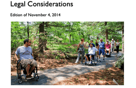
This document contains scoping and technical requirements for accessibility to sites, facilities, buildings, and elements by individuals with disabilities.

by Rails to Trails Conservancy
The purpose of this study is to provide a preliminary assessment and concept plan for developing a shared-use path along the New York Avenue corridor within the defined study area. Conducted as the first phase of determining feasibility for trail development, this preliminary assessment did not include extensive stakeholder outreach but can be used to inform future public participation and stakeholder outreach efforts in the next phase of planning.
by Federal Highway Administration
The purpose of this paper, intended for transportation practitioners and decision-makers, is to define transportation equity-related terms in the context of planning for bicycle and pedestrian facilities and programs; synthesize and highlight recent research findings related to the travel needs of traditionally underserved populations and the role of pedestrian and bicycle planning in addressing equity concerns; and to share strategies, practices and resources to address bicycle and pedestrian planning inequities.
by Federal Highway Administration
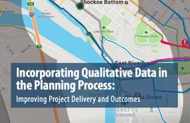
This report highlights emerging tools, techniques, and resources for gathering qualitative public and stakeholder input to inform the planning process, improve project outcomes, and contribute to streamlining project delivery.
by Federal Highway Administration
This Workbook describes thirteen (13) key strategies that have been used effectively to accelerate multimodal projects and provides examples and case studies for each.
by Federal Highway Administration
Conducting a simple assessment can be an effective first step in beginning a conversation about how to improve walking and bicycling networks.
The Standard Trail Plans and Specifications reflect current Forest Service trail management efforts and the agency’s Trails Data Dictionary for constructed features and tasks.
by Federal Highway Administration
Shared paths are paved, off-road facilities designed for travel by a variety of nonmotorized users, including bicyclists, pedestrians, skaters, joggers, and others. Shared-path planners and designers face a serious challenge in determining how wide paths should be and whether the various modes of travel should be separated from each other.
by Equine Land Conservation Resource
The future ability of people to enjoy and keep horses in open spaces will hinge largely on the efforts of today's equestrian users. What is the alternative? Loss of trails for equestrians. Now is the time to get organized!
by Federal Highway Administration
The purpose of this guide is to introduce practitioners and others to: 1) the findings of our study on the quality of service on trails; 2) a new analytical tool called the Shared-Use Path Level of Service (LOS) Calculator, and 3) potential implications for trail design.
Recreational trails and rivers can really help boost a community’s tourism traffic. This guide is designed to help leaders of these Trail Towns take advantage of the economic opportunity brought by the attraction of trails and rivers. It will help you transform your town into a more inviting and memorable tourist destination as well as a better place for residents to live, work and play. The elements in this guide are only suggestions. Feel free to modify or adapt these ideas in Assessments I & II to best suit your town. After all, your approach should be as unique as your community.


