This guide walks advocates and trail planners through the steps needed to see a greenway trail completed. The first section outlines the steps needed to get a project started, from identifying the corridor to cultivating the vision that will help inspire engagement and public support, and eventually lead to buy-in from state and/or local government.

New York State has more than two thousand miles of open greenway trails and nearly fifteen hundred miles of potential trail corridors. With all of the opportunities for growth (including 1,300 miles of planned or proposed greenway trails), there is a need for statewide resources that help local advocates navigate the process for future development opportunities outlined in the Statewide Greenways Trails Plan.
The statewide greenway network witnessed tremendous growth over the last decade, due in large part to an influx of funding to support the completion of the Empire State Trail (EST). Efforts to close the gaps in the Hudson River Valley Greenway and the Erie Canalway Trail led Governor Cuomo to announce this ambitious and visionary project in 2017. The EST closed critical gaps in the existing greenway trail network and created a unified branding and standard set of wayfinding and informational signage for this 750-mile megatrail corridor. Completed at the end of 2020, the EST is the nation’s longest statewide shared-use trail network, stretching 750 miles through the Hudson and Champlain Valleys from New York City to the Canadian border, and west along the Erie Canalway Trail from Albany to Buffalo. The EST is a recreation destination, economic driver and tourism generator which connects 20 regional trails into one contiguous statewide signed route. It is 75 percent off-road, providing a safe and accessible route for cyclists, hikers, runners, cross-country skiers and snow-shoers.
Financial support secured through public-private partnerships, as well as state and federal grant funding opportunities have enabled greenway development as part of the EST and beyond throughout the state and cemented New York’s position as a national leader in outdoor recreation. Not only does the greenway network attract visitors from across the nation and abroad to experience the historic communities, as well as varied and beautiful landscapes, but it serves as an accessible transportation alternative for people of all ages and abilities. Ten years ago, New York’s statewide trail network looked much different than it does today— and it will continue to transform as public agencies, nonprofits, members of the general public, and local leaders identify new connections to and from the EST.
This guide should inspire creativity and enthusiasm among various stakeholder groups about the important role that local residents and stakeholders can play in this process. The steps outlined will provide a high-level overview of the various aspects of trail development from initial concept to construction, and how participation from a broad range of individuals, agencies, organizations, and landowners will factor in throughout.
This guide walks advocates and trail planners through the steps needed to see a greenway trail completed. The first section outlines the steps needed to get a project started, from identifying the corridor to cultivating the vision that will help inspire engagement and public support, and eventually lead to buy-in from state and/or local government. The second section walks through the trail planning and development process, including completing a feasibility study for a trail, securing the corridor through purchase or easements, identifying grant funding opportunities, and finally getting the project designed, permitted and built.
Attached document published January 2024

Parks & Trails New York is New York's leading statewide advocate for parks and trails, dedicated since 1985 to improving our health, economy, and quality of life through the use and enjoyment of green space.
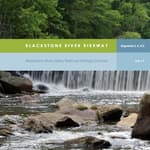
Blackstone River Bikeway (2017)
posted Apr 19, 2024
The Blackstone River Bikeway is a 48-mile-long route connecting Worcester, Massachusetts with Providence, Rhode Island. The Bikeway generally follows the historic Blackstone River and utilizes an off-road multi-use path and an on-road facility.
posted Apr 17, 2024
This report summarizes guidance and best practices to create safer bicycle facilities and connect them into networks that allow more people to safely bike to more places within and throughout communities.
Wilderness Stewardship Plan Handbook
posted Mar 27, 2024
The purpose of the Wilderness Stewardship Plan Handbook 2014 is to provide direction for creating wilderness stewardship plans, driven by the concept of preserving wilderness character. The Handbook focuses on how to incorporate wilderness policy and wilderness character into a wilderness stewardship plan and also offers a general overview of planning and compliance to be useful for those with and without a professional background in planning.
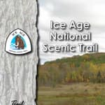
Ice Age National Scenic Trail: Trail Stewardship Notebook
posted Mar 27, 2024
The Ice Age National Scenic Trail (NST) is a thousand-mile footpath highlighting Wisconsin’s renowned Ice Age heritage and scenic beauty. The Ice Age Trail Alliance (IATA) and its partners can shape users’ experiences. As stewards of the land and the Trail, we can help users develop a connection with the land and create a sense of wonder — even pique their curiosity enough to further explore the Trail.
303 views • posted 01/26/2024