The Palmetto Trail Statewide Master Plan establishes a ten-year vision for completing and expanding the Palmetto Trail from South Carolina's mountains to its coast.
by Palmetto Conservation Foundation, Alta Planning + Design
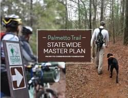
More than two decades ago, the Palmetto Trail was conceived as a cross-state trail that would serve as a spine for a network of bikeways and trails in South Carolina. Since its inception in 1994, the Palmetto Trail has been spearheaded by the Palmetto Conservation Foundation (PCF), a statewide nonprofit organization. Through the work of PCF and its volunteers and partners, 25 passages of the trail are complete and are enjoyed by South Carolina residents and visitors. This represents approximately 350 miles of the 425-mile route originally envisioned. In the Upstate of South Carolina, the Oconee Passage at Oconee Station State Historic Site serves as the trail’s northern terminus. In the Low Country, the trail terminates at the Awendaw Passage in the Buck Hall National Recreation Area at Francis Marion National Forest.
PCF's work is defined by three major program areas: conversation of natural areas, preservation of Revolutionary War battlefields, and development of the Palmetto Trail and other greenways in South Carolina. PCF complements these programs with organized activities for outdoor education and recreation and with a small publishing arm. In the last twenty five years, as the Palmetto Trail has developed and PCF has evolved, the organizational needs and focus have changed.
This Master Plan is a guide book to be used by PCF and its partners to guide the completion of the Palmetto Trail within the next ten years. The Plan additionally serves as a resource for marketing, managing, and maintaining the trail at the statewide level and also at the local level.
Attached document published April 2014
To conserve South Carolina’s natural and cultural resources, preserve historic landmarks, and promote active outdoor recreation on the Palmetto Trail and other greenways.
Visit Palmetto Conservation Foundation
Alta is more than a planning and design firm – our 200 expert planners, engineers, designers and encouragement specialists are on hand for each and every aspect of the work needed to help you create your active community.
Alaska’s Statewide Comprehensive Outdoor Recreation Plan (SCORP) 2023-2027
posted Oct 16, 2023
Outdoor recreation is vital to the lives and livelihoods of Alaskans. The state’s stunning wild landscapes, vast expanses of public land, productive ecosystems, vital cultural traditions, and four seasons of outdoor adventure position Alaska to be a world leader in outdoor recreation.
Gwinnett Countywide Trails Master Plan
posted Aug 16, 2023
Gwinnett County is currently the second most populous county in Georgia with more than 936,000 residents and also has a minority-majority population. By 2050, estimates project Gwinnett could grow to as many as 1.5 million residents, making it the most populated county in the state.
Top 10 Requests for Trails and Outdoor Recreation Master Plans
posted Apr 2, 2023
Tony Boone and Jon Altschuld are both Board Members of the Professional TrailBuilders Association (PTBA), and both will be presenting at the 2023 American Trails/PTBA International Trails Summit. Their companies, Tony Boone Trails, and Chinook Landscape Architecture are Sierra-level sponsors for the conference.
Sun Corridor Trail Alliance Action Plan
posted Sep 29, 2021
The SCTA Action Plan serves as a checklist of guiding tasks for the new organization as it continues to move the Sun Corridor Trail forward.
407 views • posted 08/03/2020