
Education and Communication
Recreation Maps and Educational Materials - Wyoming
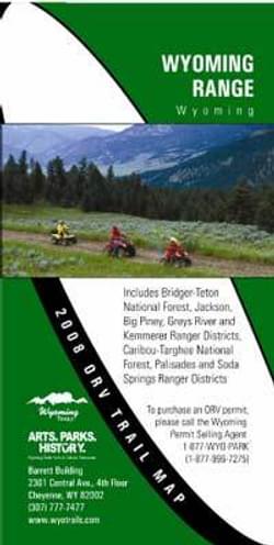
Wyoming State Trails Off Road Recreational Vehicle program develops maps for motorized recreation routes.
The Wyoming State Trails Off Road Recreational Vehicle program developed ORV maps that are provided free of charge to users from Wyoming and out of state as well. The maps were designed in Arc Map format with assistance and input from US Forest Service and Bureau of Land Management offices, ATV groups and Wyoming Game and Fish among others.
The maps not only highlight trail systems, but also include information about ethics, tread lightly, permit-selling agencies, hunting, rules, regulations, and safety.
Production of the maps began in 2003 and they are updated yearly. Nine maps are now constructed and printed each year. Maps can be requested from the Wyoming State Trails Program website or by phone. Flat copies of each map are placed on kiosks and used at trailheads.
More winners of this award
2023: Avalanche Beacon Checking Station Signs
2023: Sensible, Courteous, Off-Road, Enthusiasts / SCORE
2021: Sign Language Saturday
2020: Nevada’s Outdoor School’s Outdoor Ethics Program
2019: Gallatin National Forest Avalanche Center (GNFAC) – Montana
2018: Spearhead Trails - Virginia
2017: Woodruff Greenway Trail - South Carolina
2016: Great Trails: Providing Quality OHV Trails and Experiences Guidebook (Nationwide)
2015: Blue Tree Trail System - Nevada
2014: Missouri State Parks Trail Book
2013: School Messaging Program - Minnesota
2012: Intertwine Alliance Bi-State Regional Trails Website - Oregon and Washingston
2011: Shadow Mountain Trail System - Wyoming
2010: Coalition of Recreational Trail Users Educational Trailer - Minnesota
2009: Giant's Stairs Trail Project - Maine
2007: Trail Planning, Design & Development Guidelines Book - Minnesota
2006: Washington & Old Dominion Railroad Regional Park - Virginia
2005: North Slope Trailer Project - Wyoming
2004: Western Wyoming Avalanche Education - Wyoming
2004: Sensible, Courteous Off Road Enthusiasts (SCORE) - Pennsylvania
2003: Green Ridge State Forest & Rocky Gap State Park Trail - Maryland