This Toolkit documents the San Jose’s approach to quality planning and design to ensure a common understanding by all persons involved in the championing, planning, and design of trail projects.
by City of San Jose - Parks, Recreation, and Neighborhood Services
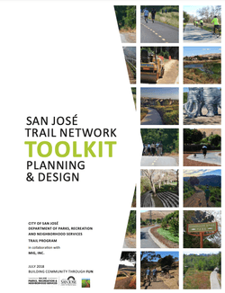
The City of San José is a recognized national leader for trail development and its network approach to ensure equitable access to recreation and active transportation trails. The high quality of San José’s trail network occurred through a focus on innovation, data-driven decision making, access through major barriers, beneficial partnerships, and focused and rapid paced development. This Toolkit documents the City’s approach to quality planning and design to ensure a common understanding by all persons involved in the championing, planning, and design of trail projects.
Use of this toolkit and adherence to its guidelines ensure that trails meet functional and aesthetic objectives, provide common and familiar infrastructure, and advance the state of the practice. The Toolkit is purposely general and broad when defining preferred planning and design approaches.
San José has one of the nation’s largest trail networks which leads to numerous opportunities and constraints. Planners and designers should view the Toolkit as a starting point and rely on related local, state, and federal documents for detailed guidance based on specific site conditions.
The Toolkit has been formatted for quick access to key details. It serves as a starting point to gain a general understanding of the “why” and “what” of planning and design decisions. Photographs, figures, and charts are used when possible to reinforce subject matter.
Attached document published July 2018

San José has hundreds of unique and breath-taking venues perfect for an outside day. Visit one of San José’s 200+ parks, hike along 60 miles of scenic trails or visit a regional park.
Visit City of San Jose - Parks, Recreation, and Neighborhood Services
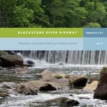
Blackstone River Bikeway (2017)
posted Apr 19, 2024
The Blackstone River Bikeway is a 48-mile-long route connecting Worcester, Massachusetts with Providence, Rhode Island. The Bikeway generally follows the historic Blackstone River and utilizes an off-road multi-use path and an on-road facility.
posted Apr 17, 2024
This report summarizes guidance and best practices to create safer bicycle facilities and connect them into networks that allow more people to safely bike to more places within and throughout communities.
Wilderness Stewardship Plan Handbook
posted Mar 27, 2024
The purpose of the Wilderness Stewardship Plan Handbook 2014 is to provide direction for creating wilderness stewardship plans, driven by the concept of preserving wilderness character. The Handbook focuses on how to incorporate wilderness policy and wilderness character into a wilderness stewardship plan and also offers a general overview of planning and compliance to be useful for those with and without a professional background in planning.
Ice Age National Scenic Trail: Trail Stewardship Notebook
posted Mar 27, 2024
The Ice Age National Scenic Trail (NST) is a thousand-mile footpath highlighting Wisconsin’s renowned Ice Age heritage and scenic beauty. The Ice Age Trail Alliance (IATA) and its partners can shape users’ experiences. As stewards of the land and the Trail, we can help users develop a connection with the land and create a sense of wonder — even pique their curiosity enough to further explore the Trail.
532 views • posted 07/23/2018