
posted Feb 15, 2024
American Trails sends out two monthly eNewsletters to the trails community: our beloved Trail Tracks eNewsletter and our new Pathways Professional Development eNewsletter.
posted Feb 12, 2024
We are excited to announce the projects we selected for funding for the 2024 Legacy Trail Program grant cycle. In this second year of the program, we funded a total of $1.35 million to 27 organizations.

posted Feb 7, 2024
American Trails is partnering with Trans Canada Trail to launch the inaugural North American Trail Sector Survey.

posted Feb 1, 2024
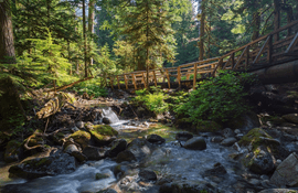
Trails and greenways create healthy recreation and transportation opportunities by providing people of all ages with attractive, safe, accessible and low- or no-cost places to cycle, walk, hike, jog or skate.

posted Jan 26, 2024
This guide walks advocates and trail planners through the steps needed to see a greenway trail completed. The first section outlines the steps needed to get a project started, from identifying the corridor to cultivating the vision that will help inspire engagement and public support, and eventually lead to buy-in from state and/or local government.
posted Jan 22, 2024
The Call to Action provides strategies that communities can use to support walking, which we hope will result in long-lasting changes to improve the health and health care of Americans today and of the generations that follow.
posted Jan 19, 2024
The results are in! Here are our picks from the 483 photos submitted for the 2023 photo contest.

posted Jan 12, 2024
Trails, if designed well, can promote equitable access to the outdoors for people of all ages and abilities, bringing together people with diverse social, racial, gender, and economic identities. Inclusive trails don't just happen. It takes a robust public engagement process, inclusive approaches to trail programming, public awareness efforts and trail enhancements to meet the diverse needs of the entire community.
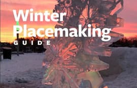
posted Jan 2, 2024
by 8-80 Cities
The Winter Placemaking Guide is dedicated to community leaders, policymakers and all types of community changemakers who seek to improve their surroundings during the winter season.
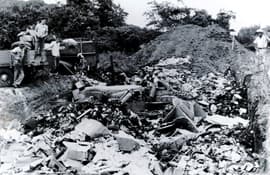
posted Dec 31, 2023
From Trash to Treasure. What used to be a landfill in Springfield, Missouri is finding new use.
posted Dec 29, 2023
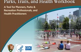
by National Park Service, Centers for Disease Control and Prevention
Consider this workbook as a starting point. Every project is different. This workbook is intended as a guide to be adapted for specific situations.
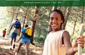
posted Dec 29, 2023
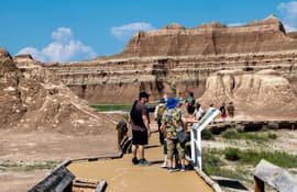
Call it walking. Call it hiking. Seldom has something so much fun also turned out to be so good for us!
Page 3 of 132


