
posted Feb 19, 2018
This presentations discusses unique opportunities for trail development along the right of way adjacent to railroad tracks.


posted Feb 19, 2018
GIS tools are being used to make investment decisions on developing new trail systems and managing existing trail systems.

posted Feb 19, 2018
by Randy Martin with Trailscape
Learn how to plan an initial trail layout.

posted Feb 19, 2018
by Dan Kleen with National Off-Highway Vehicle Conservation Council (NOHVCC), Karen Umphress with UP! Outside
Access for people with disabilities

posted Feb 19, 2018
Introduction to various aspects of implementing a wayfinding program.

posted Feb 19, 2018
Drawing from dry-laid rock fences, a significant equine heritage, and one of the oldest urban growth boundaries in the nation, Legacy Trail spans the gamut of landscapes.

posted Feb 19, 2018
This session endeavors to describe multiple projects that are currently bucking this trend- restoring natural systems, providing high quality recreation, and inviting communities back into the woods.

posted Feb 19, 2018
by Dan Jatres with New Orleans Regional Planning Commission, Brandon Ross with City of San Antonio Parks and Recreation Department
This session will focus on addressing the challenges of coordinating with multiple agencies for shared use of space in floodplains.

posted Feb 19, 2018
The nation’s longest paved trail network is a 340-mile accomplishment and a point of pride in Ohio.

posted Feb 19, 2018
Planning and implementation of three complex regional trail systems in three western states.
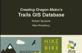
posted Feb 19, 2018
by Robert Spurlock with Oregon Metro Regional Government, Max Woodbury with Oregon Metro Regional Government, Jenny Konwinski, Reid Ammann
The task of developing GIS databases.


