posted Jul 23, 2020
by Federal Highway Administration
The Guidebook for Measuring Multimodal Network Connectivity is a guide for transportation planners and analysts on the application of analysis methods and measures to support transportation planning and programming decisions. It describes a five-step analysis process and numerous methods and measures to support a variety of planning decisions. It includes references and illustrations of current practices, including materials from five case studies conducted as part of the research process.

posted Aug 21, 2020
by Bureau of Land Management, International Mountain Bicycling Association (IMBA)
In the context of mountain bike trails, excellence is realized when a trail design merges the desired outcomes and difficulty that a rider seeks with the setting in which the outcomes are realized.

posted Sep 18, 2023
by Minnesota Department of Natural Resources
These guidelines are designed to assist resource managers in conducting management activities that enhance the quality of natural plant communities, wildlife habitat, regional landscape integrity and visual quality, particularly as related to planning, development, and maintenance of trails, water trails, and water access sites.

posted Jan 16, 2018
The Ontario Trails Strategy describes our vision for trails in Ontario and recognizes the many benefits of trails for health and prosperity and highlights the importance of environmental protection.
posted Jan 19, 2018
The purpose of this document is to provide desirable and minimum trail design standards to municipalities applying for county open space funds to develop trail connections. The municipality’s open space plan must indicate connections to existing or proposed county trails, and county parks and historic sites to be eligible for county trail funding.

posted Aug 16, 2023
by Gwinnett County Department of Community Services
Gwinnett County is currently the second most populous county in Georgia with more than 936,000 residents and also has a minority-majority population. By 2050, estimates project Gwinnett could grow to as many as 1.5 million residents, making it the most populated county in the state.

posted Nov 23, 2020
by Gwinnett County Department of Community Services
Gwinnett County is currently the second most populous county in Georgia with more than 936,000 residents and also has a minority-majority population. By 2050, estimates project Gwinnett could grow to as many as 1.5 million residents, making it the most populated county in the state.

posted Feb 14, 2022
by Kimley-Horn Planning and Design Engineering Consultants
The purpose of the Highway-Rail Crossing Handbook, 3rd Edition is an information resource developed to provide a unified reference document on prevalent and best practices as well as adopted standards relative to highway-rail grade crossings.

posted Feb 19, 2018
A case study for examining the challenges and potential of long-distance hiking trails in a region affected by political instability.
posted Aug 13, 2020
by U.S. Fish & Wildlife Service
The purpose of this study is to provide baseline historical information pertaining to those portions of the Trail of Tears National Historic Trail that cross onto lands managed by the FWS at the White River National Wildlife Refuge (NWR) in Arkansas, the Wheeler NWR in Alabama, and the Tennessee NWR in Tennessee.
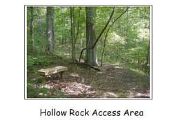
posted Aug 13, 2020
The planned Hollow Rock Access Area is a multi-jurisdictional project to conserve significant natural and cultural resource lands along New Hope Creek and to make portions of the site available for low-impact recreational uses.

posted May 3, 2018
The objective of this study was to determine the type of pathway that would best satisfy the needs of the Village of Hoosick community.


