Produced by the RBA Group for the Pennsylvania Greenways Partnership Commission and the Greenways Partnership Advisory Committee
This plan is designed to provide a coordinated and strategic approach to creating connections through the establishment of greenways.
What is a Greenway?
Pennsylvania Greenways - An Action Plan for Creating Connections, has this definition:
"A greenway is a corridor of open space, varying greatly in scale, and incorporating or linking diverse natural, cultural, and scenic resources. Some greenways are recreational corridors or scenic byways accommodating pedestrian and non-motorized vehicle traffic on both land and water; while others function almost exclusively for environmental protection and are not designed for human passage."
HOW IS A GREENWAY PLAN DEVELOPED?
Sound Greenways Planning uses a three-step process that answers the following questions:
Where Are We Now? This is the inventory phase, during which information about the County’s natural, cultural, historical, and scenic assets is gathered, forming the building blocks of conservation and/or recreation corridors. For example, it is important to note critical habitat areas, as well as abandoned rail lines that have potential for conversion into recreational trails.
Where Do We Want to Be? In this phase, the “Vision” for the greenways system is developed. Specifically, the plan synthesizes information gathered in the inventory phase into a proposed network of greenways and trails linking important destinations throughout the County.
How Do We Get There? This phase provides information and recommendations on the implementing the Greenways Plan. It includes concrete tools such as recommended management structure, prioritized trail and greenway segments, potential funding sources, and suggestions for pilot/demonstration projects.
Public Participation
Greenway planning also involves an intensive public participation process that solicits knowledge and expertise from local residents and officials - those who know Lawrence County best. During this process, input is obtained by the following methods:
• Study Committee Meetings - A Project Study Committee was assembled to help guide the planning process. Members included representatives of County Government, local school districts, and non-profit organizations having expertise in planning, recreation, agriculture, and conservation. The Study Committee reviewed and commented on all aspects of the Greenways Plan as it was developed.
• Public Meetings - Two meetings were held to obtain feedback on the plan from the general public. The first meeting was held in November 2006 to introduce the planning process and solicit information about significant County destinations, natural areas worth conserving, and potential trail opportunities. The second meeting was held in July 2007. At this session, the draft Greenways Plan was presented and the public was asked to comment on the recommendations. Significant comments were addressed in the final plan.
• Key Person Interviews - Using a contact list developed by the Study Committee, as well as contacts with local organizations made during the planning process, twenty interviews were conducted with individuals and organizations knowledgeable on local issues, including conservation, development, economic impact, recreation, and tourism.
• Focus Groups - In addition, Pashek Associates held meetings with focus groups, or local organizations interested in various aspects of the Greenways Plan. An example is the Slippery Rock Creek Gorge Focus Group meeting held in August 2007. The focus of such meetings was concentration on each group’s interests that may parallel ideals of greenway planning.
Purpose of the Greenways Plan
With the aforementioned benefits and planning process in mind, this Plan examines the various methods by which Lawrence County can develop a greenway network that will help to preserve its essential natural resources and, in turn, its unique character and quality of life. The purpose of this project is to develop a network of connections between the County’s diverse natural areas, its various cultural, historic, and recreational resources, and local population centers. These connections will help to preserve the County’s natural resources and open spaces while providing valuable recreational opportunities for local residents.
Goals and Objectives
Preserving and enhancing Lawrence County’s character and quality of life is the main goal of the Greenway Plan, and these specific objectives support this main goal:
• Protect existing natural areas primarily for ecological health and preservation of wildlife habitat;
• Promote the preservation of agricultural land;
• Provide recreational opportunities for County residents through preservation and connection of existing open spaces;
• Promote economic growth via recreational or eco-tourism;
• Encourage local municipalities to work in unison to help protect their various resources by adopting open-space and land-use regulations;
• Educate County residents on the aspects and benefits of Greenways Planning, including the benefits of implementation of the goals listed above.
The Greenway Plan As a Decision-Making Tool
Once finalized and approved by the Lawrence County Commissioners and adopted as part of the County’s recent Comprehensive Plan (2004), the Greenway Plan will serve as a flexible tool for making decisions regarding the protection of its natural, cultural, historic, and scenic resources. By encompassing a variety of issues pertinent to these resources, the Plan will lay the foundation for the continued success of open space conservation and increased quality of life in Lawrence County. Specific policy details and greenway locations may be adjusted as needed throughout the planning process and implementation. Sound Greenway Planning includes inventory and analysis of natural features, cultural and historic sites, and open spaces such as parks or nature reserves; along with collaboration with local government agencies, private groups, and interested citizens to form policies for development and/or conservation. This multi-layered approach, involving Lawrence County and its decision-makers, yields short-, medium-, and long-term strategies for natural resource conservation and greenway development in harmony with any potential economic development.
THE CRITERIA
Greenways can serve many functions. When determining the guiding principles used to designate greenways for Lawrence County, we considered the objectives established in the early part of the planning process. The following goals and objectives offer insight into the function of the greenways to be developed in the county: Preserving and enhancing Lawrence County’s character and quality of life is the main goal of the Greenway Plan, and these specific objectives support this main goal:
• Protect existing natural areas primarily for ecological health and preservation of wildlife habitat;
• Promote the preservation of agricultural land;
• Provide recreational opportunities for county residents through preservation and connection of existing open spaces;
• Promote economic growth via recreational or eco-tourism;
• Encourage local municipalities to work in unison to help protect their various resources by adopting open-space and land-use regulations;
• Educate county residents on the aspects and benefits of Greenways Planning, including the benefits of implementation of the goals listed above.
These goals and objectives support the two general functions that define proposed Greenways in Lawrence County:
1) Conservation Greenways are corridors whose primary function is preservation of sensitive environmental features and habitats, such as wetlands, steep slopes, fl oodplains, exceptional value water-quality streams, high-value natural areas identified by the Lawrence County Natural Heritage Inventory, outstanding geologic or scenic features, and land surrounding the county’s drinking water sources. They are linear tracts of essentially undeveloped open space. Some low-impact activity, like hiking or wildlife observation, is acceptable in these corridors, but intense development and motorized vehicle use are not recommended.
2) Recreational and Transportation Greenways are corridors in which trail development is recommended. These greenways connect population centers and points of interest. They bring people into contact with the outdoors and engender an appreciation of the natural world. These trails also provide alternative, environmentally-friendly transportation options for commuters and visitors. In some cases, recreational trails overlay areas where conservation of natural assets is also an objective. To avoid confl icts, recreational uses should be planned to minimize impacts. For example, a biking trail along a river or stream corridor should be designed to preserve steep slopes, wetlands, and other sensitive areas.
STRATEGIES FOR IMPLEMENTATION
This section of the Greenways Plan offers step-by-step recommendations outlining the process of implementing the proposed greenways network in Lawrence County. This is the sequence of events needed to carry the Greenways Plan from the “vision” described earlier to completion of conservation and recreation greenway corridors. For each broad objective, the tables specify a sequence of prioritized tasks, along with respective estimated costs, and parties responsible for leadership and assistance in the undertaking of each task. Responsible parties will need to seek funding through grants or cost reimbursement programs throughout the implementation process. This section also provides lists of potential funding sources. Tasks are prioritized into three designations:
Short-term (S) priorities should be accomplished in the first 2 years after official adoption of the Greenways Plan. These strategies will lay the foundation for successful implementation of the greenways plan.
Middle-term (M) priorities should be undertaken in years 3 through 5.
Long-term (L) priorities are expected to begin 5 or more years down the road.
Many of the strategies listed have little or no cost beyond the administrative costs to be incurred by the responsible parties. Where recommended tasks require an additional expense for implementation, a cost estimate is included. It is essential to note that costs are “ball park” figures, in 2007 dollars, based on similar projects or initiatives. Detailed cost estimates will need to be developed through feasibility studies.
Advancing Individual Greenway Segments
The following steps show the process that the LCPD, via the Greenways Coordinator, may take to advance the implementation of a specific greenway segment.
1) Approach municipalities to educate them on the benefits of establishing greenways.
2) Work with municipal officials to identify a demonstration project that will result in a success story, and achieve consensus and support for advancing the project.
3) Meet with municipal officials and other local supporters to discuss greenway protection and/or trail development, plan a strategy for approaching landowner(s) in the project area, and identify land trusts or other organizations as possible partners.
4) Determine who will hold property or easement if property acquisition or easement establishment is successful.
5) Assist municipalities and partners in determining the need for further planning and the feasibility of property acquisition or easement establishment. If additional planning is required, proceed directly to step 10.
6) Help municipal officials and partners to anticipate questions, issues, and concerns of landowner(s). Prepare a response detailing how proper planning will specifically address landowner questions and issues, alleviate concerns, and promote healthy relationships between the municipality and landowner(s).
7) Coach municipal officials and partners in preparing to negotiate the acquisition or establishment of easements on the greenway segment.
8) Approach landowner(s) with municipal officials and partners to discuss the project, identify landowner issues / concerns, and address ability of planning and design to address those concerns in an manner acceptable to the all parties. Ask landowner(s) permission to advance planning and design of the greenway segment. Schedule a follow- up meeting with landowner to present a conceptual design for the greenway segment.
9) Accompany municipal officials and partners to present preliminary planning and design of greenway segment, ask owner if his/her concerns have been sufficiently addressed. Revise planning and/or design if necessary until acceptable to all parties.
10) Review methods of acquisition and preservation and negotiate with landowners to acquire property or establish easement(s).
11) Arrange for County Solicitor to arrange legal paperwork for acquisition of property or establishment of easements in greenway segment.
12) Assist municipality in establishing a construction budget, and determine the county’s level or participation in development of the greenway segment.
13) Help with preparation of grant applications to secure funding for acquisition and/or development of greenway segment.
14) Oversee development of greenway segment.
Attached document published June 2001
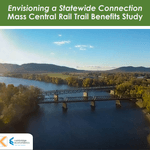
Envisioning a Statewide Connection Mass Central Rail Trail Benefits Study
posted Jun 14, 2023
Study shows completion of the Massachusetts Central Rail Trail System would bring significant health and economic benefits to the commonwealth.
posted May 15, 2023
Mountain Bike Trail Development: Guidelines for Successfully Managing the Process,” a 242-page “how to” manual covers modern trail development from trail types, to landscape analysis and design, to environmental and construction considerations, cost implications and more.
The Beerline Trail Equitable Implementation Plan – 2019
posted Sep 21, 2021
The Beerline Trail Neighborhood Development Project was created to ensure the next phases of trail development serve the needs of the community.
Planning and Managing Environmentally Friendly Mountain Bike Trails
posted Dec 22, 2020
This guidebook can be used to assist in successfully planning, designing, and constructing mountain bike trail systems, while keeping in mind that user issues must be addressed at every stage of development.
261 views • posted 03/13/2018