Rails to Trails Conservancy (RTC) released a report this week detailing how investing in active transportation positively impacts communities.
Rails-to-Trails has released a report detailing how and why investing in infrastructure that can help those taking short trips use methods other than automobiles to reach their destination. According to RTC half of all trips in the United States fall into a 20 minute window of distance using walking or biking, yet the main mode of transportation for these trips is automobiles. By investing in infrastructure changes to promote walking and biking communities reap endless benefits, including significant economic and health benefits.
Attached document published October 2019
Why Trails Matter: Trails and Greenways Promote Health
posted Feb 1, 2024
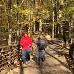
Trails and greenways create healthy recreation and transportation opportunities by providing people of all ages with attractive, safe, accessible and low- or no-cost places to cycle, walk, hike, jog or skate.
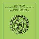
STEP IT UP! The Surgeon General’s Call to Action to Promote Walking and Walkable Communities
posted Jan 22, 2024
The Call to Action provides strategies that communities can use to support walking, which we hope will result in long-lasting changes to improve the health and health care of Americans today and of the generations that follow.
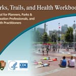
Parks, Trails, and Health Workbook
posted Dec 29, 2023
Consider this workbook as a starting point. Every project is different. This workbook is intended as a guide to be adapted for specific situations.
posted Dec 29, 2023
Call it walking. Call it hiking. Seldom has something so much fun also turned out to be so good for us!
248 views • posted 10/17/2019