Developing a more uniform, systematic and data-driven process to set capital construction and maintenance priorities was vital to ensure funding is going to the highest priority projects.
During its 18-year existence, Colorado Fourteeners Initiative (CFI), a nonprofit partner of the US Forest Service, has constructed 26 sustainable summit routes on 24 Fourteener peaks to facilitate hiking access while protecting rare and fragile alpine tundra ecosystems, including some plant species that are unique worldwide.
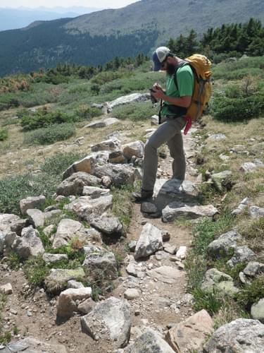
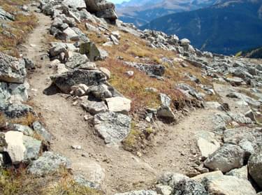
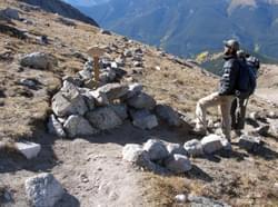
Summit hiking trails, most located in designated wilderness, are built by hand using primitive tools and native materials. These trails are located in some of the most inhospitable areas in the Lower 48 states and are subject to extreme erosion due to loose alpine soils, intense precipitation, and recreation-caused impacts.
The Fourteener summit trail network represents one of the most popular alpine hiking trail systems in the country. On an annual basis CFI invests roughly $1.2 million into this trail system through grants, donations, in-kind support, and the value of labor provided by volunteers. New summit trail projects can take up to four years and cost almost $500,000 to complete, so maintaining these investments is vital.
CFI’s Sustainable Trails Program was envisioned as a way of more systematically inventorying and managing this growing system of high-altitude hiking trails to ensure that prior capital investments are managed over time to retain their value, and that funding for capital construction and maintenance work is invested in the highest priority projects.
Historically, CFI’s future trail construction projects were prioritized based on a Long Range Plan originally completed in 1999 that was updated and reprioritized annually. Maintenance priorities were set based on the professional judgments of CFI field crew leaders and USFS staff augmented by anecdotal reports from individual 14er hikers. While well intentioned, this process was rather subjective.
Developing a more uniform, systematic and data-driven process to set capital construction and maintenance priorities was vital— especially in a competitive funding environment— to ensure funding is going to the highest priority projects. A system that inventories construction and maintenance needs, assigns costs, and estimates person-hours needed to complete this work will help quantify how much funding and crew time will be needed to complete and maintain this extensive 14er trail network.
Given current geospatial software available, such a system can also share the current relative condition of 14er trails, work envisioned for future trail reconstruction projects, and the changes over time from ongoing maintenance projects to interested parties via the internet.
Beginning in October 2010, CFI staff, the Forest Service 14er liaison, and two Booz Allen Hamilton environmental consultants— “Adopt-a-Peak” partners with relevant professional skills in capital asset modeling and GIS technology who volunteered their professional services— met for six months to develop a mechanism for systematically collecting baseline GPS-based trail data in the field.
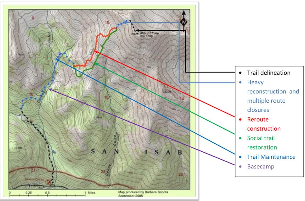
The team developed an approach for breaking trails into smaller segments (based on similar aspect, slope/side slope, and trail surface type), setting criteria for the constructed trail features to be inventoried, and assigning condition value scores for each of these identified features or documented resource problems to be addressed through the construction of new trail features. A complex scoring flow chart was developed for existing trail features (check steps, retaining walls, check dams, etc.), proposed new trail features, and resource protection issues requiring attention (erosion, braiding, trampling of vegetation, etc.).
All constructed features and resource protection issues would be photographed using a GPS-enabled camera so that the condition on a given date could be seen. Initial baseline field inventories would assess changes since construction, while subsequent field inventories would determine the rate of deterioration (due to natural change and recreation-caused impacts) or improvement (resulting from trail reconstruction and maintenance projects).
Since 14er trail construction and maintenance are done using native materials found on or near the project worksites, notations regarding the amount, location, and distance to the nearest suitable sources of rocks, trees and other native construction materials would be entered to help estimate the amount and cost of future work required. This methodology is being applied to inventories of previously constructed summit trails and existing user-created routes so that the condition of entire trails and their individual segments can be compared across all peaks.
Due to the extreme altitude at which these trails are located (11,000-14,000 feet), the limited snow-free period when inventories can be collected (mid-June through late September), and the significant number of trail issues and features to be catalogued, CFI anticipated that three field seasons would be required to complete the initial baseline inventories. Private funding was obtained to allow a pilot season of data collection to occur during the summer of 2011, which allowed field inventories to be completed on nine summit trails and partially completed on three additional summit trails.
Funding from the USFS and the Colorado State Trails Program allowed a second season of field data collection to be completed in 2012. By September 30, 2012, CFI’s project coordinator had conducted detailed GPS inventories of 26 summit routes covering 85.26 miles of trail, including the cataloging of 543 resource protection issues (estimated at 63,684 linear feet) and the documentation of 13,171 existing and proposed trail features (an average of 507 per route). Initial baseline inventories were completed during the 2013 field season.
While the inventory and analysis work is ongoing and the true maintenance modeling aspect (allowing future trail construction and maintenance costs and human resources to be forecast) has not yet occurred, CFI is already reaping significant benefits from the Sustainable Trails Program. Google Earth Pro is allowing CFI to create videos showing the current condition of existing 14er trails and the location of planned trail projects.
To date six Google Earth videos have been posted to CFI’s YouTube channel, and these videos are helping revolutionize the public involvement process for future trail reconstruction projects. Interested people, regardless of where they live in the world, can “fly over” even the most remote wilderness project to get a sense of current resource protection problems and the proposed trail work to be performed.
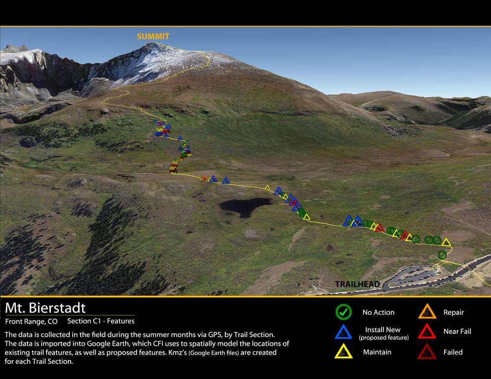
Comments are helping CFI tweak the projects based on feedback. For example, the enclosed Mount Bierstadt video flies the viewer in to the site of arguably the most heavily used 14er summit trail in the state, showing the need for future trail improvements (blue icons), the condition of existing trail structures (green through dark red), and the extent and severity of identified resource protection issues. Each icon contains detailed information and photographs about a given trail structure, resource protection problem, or needed trail feature to remedy the problem.
Other videos posted on CFI’s YouTube channel (www.youtube.com/user/CO14ersInitiative) allow interested persons to get a realistic overview of current and future trail reconstruction projects—a process that would take days to do in person. This is particularly helpful in showing funders work planned for remote wilderness locations. The completed condition value scores of summit trails (and individual trail segments) are already proving helpful in showing CFI’s board and management team the relative conditions of constructed trails and the relative need for future construction and maintenance projects.
The fusion of GIS technology and capital asset management is not new. Many organizations use such technologies to monitor changing conditions in capital assets and ensure long-term retention of value. However, CFI believes this project is unique for such a small not-for-profit (4.5 FTE, $900,000 operating revenues) to be using in managing an extensive network of elaborately constructed summit trails located in remote places across an entire state. This robust database of identified trail features, resource problems, and photographs will allow CFI to see exactly how routes are changing over time due to erosion, changes in visitor traffic patterns, and subsequent maintenance/reconstruction projects. The incorporation of Google Earth technology is allowing CFI to bring its trail management processes to the public who use these trails, helping increase understanding and linking to potential funders nationwide.
posted May 17, 2021
Levaware systems is offering IoT intelligence to create a new type of trailhead.
Incorporating Qualitative Data in the Planning Process
posted Jul 23, 2020
This report highlights emerging tools, techniques, and resources for gathering qualitative public and stakeholder input to inform the planning process, improve project outcomes, and contribute to streamlining project delivery.
State of the Art Technology for Modern Trails
posted Feb 19, 2018
Today’s techno-savvy trail users expect to be able to plan and preview their trail experience with accurate GPS and GIS data viewed in programs like Google Earth.
posted Feb 19, 2018
Explore multiple uses for GIS data beyond simple mapmaking and inventory.
1,316 views • posted 03/01/2018