You searched for “signage”
188 results
Image results for “signage”
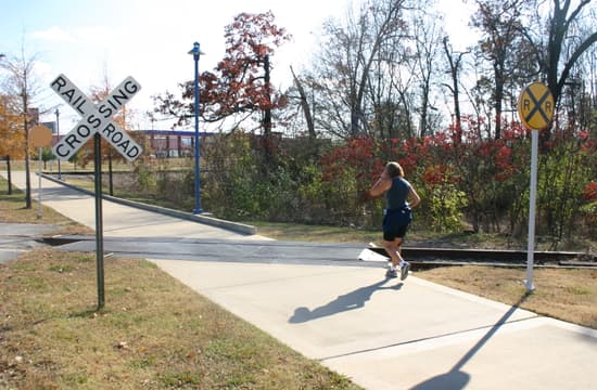
The minimum needed for a rail crossing: trail surface and signs; angled crossing is not optimum; Chattanooga, Tennessee
The minimum needed for a rail crossing: trail surface and signs; angled crossing is not optimum; Chattanooga, Tennessee
The minimum needed for a rail crossing: trail surface and signs; angled crossing is not optimum; Chattanooga, Tennessee

Trail users warned about trying to climb through a stopped train; Chattanooga, Tennessee
Trail users warned about trying to climb through a stopped train; Chattanooga, Tennessee
Trail users warned about trying to climb through a stopped train; Chattanooga, Tennessee
Sign warns trail users that railroad crosses trail at an angle; Minneapolis Cedar Lake Regional Trail
Sign warns trail users that railroad crosses trail at an angle; Minneapolis Cedar Lake Regional Trail
Sign warns trail users that railroad crosses trail at an angle; Minneapolis Cedar Lake Regional Trail
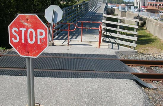
Stop signs and "chicane" gate at railroad crossing; White River Trail, Indianapolis
Stop signs and "chicane" gate at railroad crossing; White River Trail, Indianapolis
Stop signs and "chicane" gate at railroad crossing; White River Trail, Indianapolis
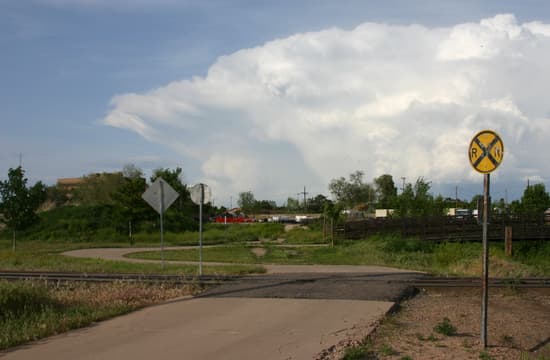
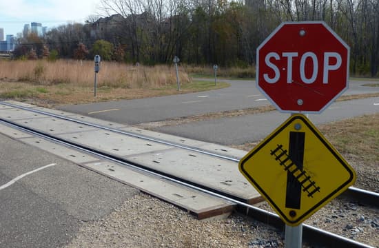
Small RR crossing signs on trail leading to Platte River Greenway; Commerce City, Colorado
Small RR crossing signs on trail leading to Platte River Greenway; Commerce City, Colorado
Small RR crossing signs on trail leading to Platte River Greenway; Commerce City, Colorado
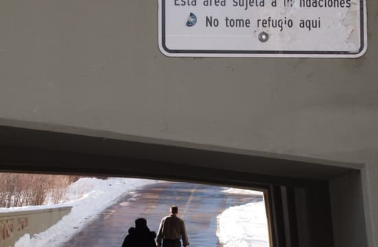
The Boulder Creek Trail runs below the water level with a retaining wall to keep out normal flows; the sign warns people not to shelter from rain here in case of flooding
The Boulder Creek Trail runs below the water level with a retaining wall to keep out normal flows; the sign warns people not to shelter from rain here in case of flooding
The Boulder Creek Trail runs below the water level with a retaining wall to keep out normal flows; the sign warns people not to shelter from rain here in case of flooding
A number of areas along Cherry Creek in Denver are flood prone; sign is rather vague as to the "dangerous conditions"
A number of areas along Cherry Creek in Denver are flood prone; sign is rather vague as to the "dangerous conditions"
A number of areas along Cherry Creek in Denver are flood prone; sign is rather vague as to the "dangerous conditions"
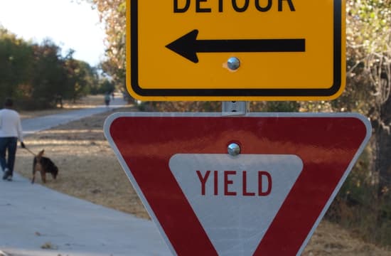
Yield signpost is used for trail detour direction in case of flood; Cherry Creek Trail in Denver
Yield signpost is used for trail detour direction in case of flood; Cherry Creek Trail in Denver
Yield signpost is used for trail detour direction in case of flood; Cherry Creek Trail in Denver
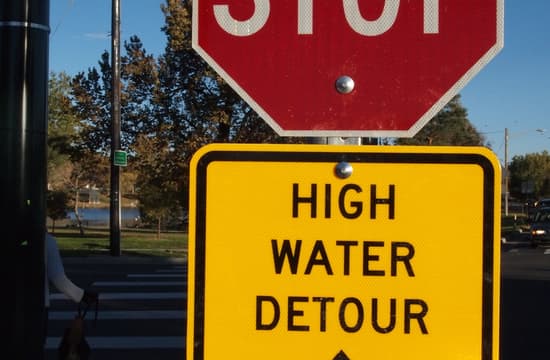
Stop sign combined with high water detour sign; Cherry Creek Trail in Denver
Stop sign combined with high water detour sign; Cherry Creek Trail in Denver
Stop sign combined with high water detour sign; Cherry Creek Trail in Denver
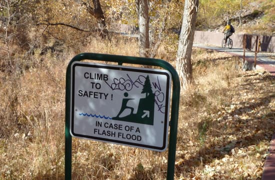
More specific advice for trail users in case of flash flood along Big Dry Creek Trail: South Suburban Park District, Colorado
More specific advice for trail users in case of flash flood along Big Dry Creek Trail: South Suburban Park District, Colorado
More specific advice for trail users in case of flash flood along Big Dry Creek Trail: South Suburban Park District, Colorado
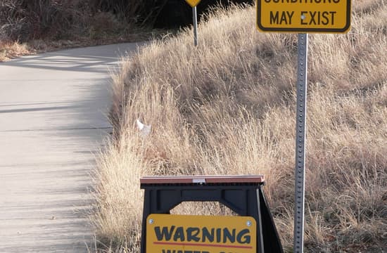
Trail may be impassable, says one of three signs approaching one underpass on the Cherry Creek Trail; Denver, Colorado
Trail may be impassable, says one of three signs approaching one underpass on the Cherry Creek Trail; Denver, Colorado
Trail may be impassable, says one of three signs approaching one underpass on the Cherry Creek Trail; Denver, Colorado
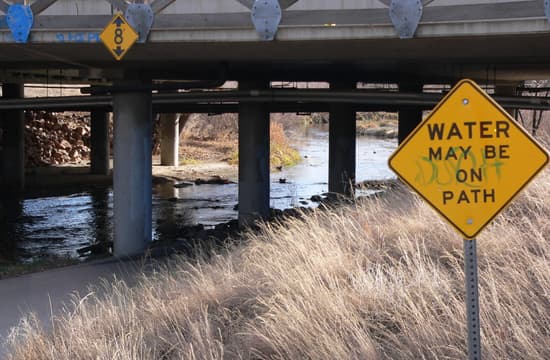
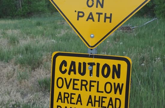
Another variation on flood warning signs, "Water may be on path" on Cherry Creek Trail; Denver, Colorado
Another variation on flood warning signs, "Water may be on path" on Cherry Creek Trail; Denver, Colorado
Another variation on flood warning signs, "Water may be on path" on Cherry Creek Trail; Denver, Colorado


