This water trail extends as far south as Creswell, OR, and as far north as St. Helens, OR. The area encompasses the entire mainstem of the Willamette River as well as portions of the Coast Fork Willamette and Middle Fork Willamette.

Designated in 2012
• View more details for this trail
in the NRT Database
• Learn about the NRT Program.
The River
The Willamette River Water Trail is an assemblage of properties that span over 200 miles (including portions of key tributaries) that provide access for paddlers to the Willamette River or afford opportunities to camp along the river.
The Willamette River Water Trail highlights the mainstem Willamette River and portions of the Coast Fork Willamette and Middle Fork Willamette, which join together to form the mainstem river in Springfield, OR. Ranking by volume as the 13th largest river in the U.S., the Willamette's mainstem lies entirely in northwestern Oregon, flowing north between the Oregon Coast Range to the west and the Cascade Range to the east. From its source waters to its confluence with the Columbia River, the Willamette courses through national forests, rich farmlands, quiet towns, and the state's largest cities. Seventy percent of Oregon's population enjoys the privilege of living in the Willamette Valley.
The Willamette’s upper stretch is typically dynamic, with fast, shallow currents rushing between small gravel islands covered with Pacific willow. The river retains this aspect in places as it moves northward and widens into the valley, with occasional pools of slower water appearing, yet with a consistent strong current between Eugene and Corvallis. In between the cities are areas of farms located in the floodplains. The current speed typically decreases north of Salem and slows down more near the Yamhill River. You then enter a stretch called the Newberg Pool.
Plants and Wildlife
The Willamette River Water Trail passes by the Ankeny National Wildlife Refuge, home to more than 200 species of birds that either visit or call the refuge home all year. Common birds include Osprey, Bald Eagles, Belted Kingfishers, Turkey Vultures, Spotted Sandpipers, Wood Duck, Merganser, and more. During the spring and summer, you can witness an array of migratory songbirds. It is common to see Spring Chinook as they migrate upstream, or in the summer months trout swimming over gravel bars just under the surface. You can also witness introduced species like Smallmouth Bass. Freshwater mussels can be found along the Upper and Mid-river.
Common mammals include Black-tailed Deer, Beaver, River Otter, Mink, Coyote, and introduced species such as Nutria. Bobcats and Cougars are also sometimes present, though relatively rare along the river corridor.
The Water Trail Project
Beginning in 2004, multiple partners in the Mid-Willamette Valley got together and decided to initiate the Water Trail Project, developing the first map that covered 35 miles. Some of the key partners included the City of Salem, the City of Keizer, the U.S. Bureau of Land Management (American Heritage Rivers Program), the National Park Service Rivers and Trails Program, Marion County, Oregon State Parks and Recreation, and Willamette Riverkeeper. In 2023 a new guide was published that consolidated the previous two printed maps into one map of the whole river, plus portions of the Middle and Coast Fork Willamette and the lower McKenzie. This guide provides up-to-date GIS maps for every stretch and bend of the Willamette. Get this great new resource here https://willamettewatertrail.o...
Today, the Oregon State Parks and Recreation Department, Willamette Riverkeeper, and a host of other partners up and down the Willamette Valley contribute in a variety of ways to support the Water Trail. Some Water Trail partners offer a City or County Park, while others place signage on their property to help guide people to the right camp spots.
Find out more>> https://willamettewatertrail.o...
Photos by Sue Crowe
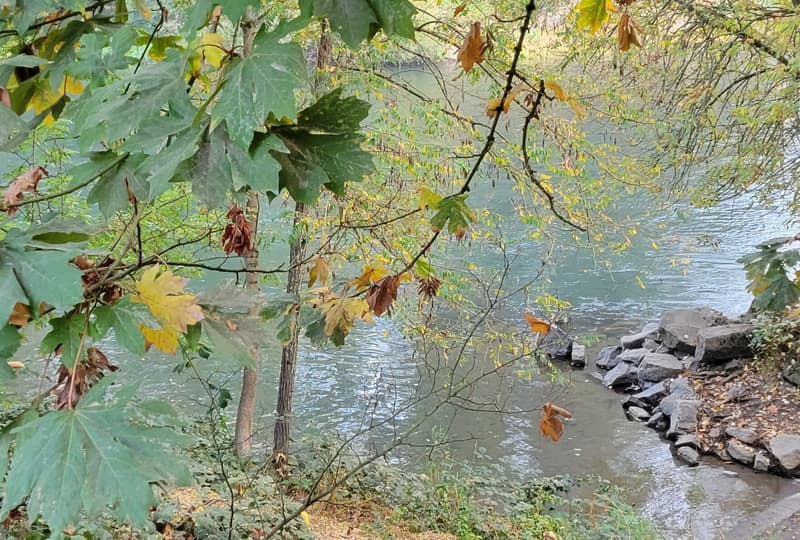
Boat launch at Armitage Park; Eugene, Oregon

Willamette River Water Trail at Armitage Park; Eugene, Oregon

Early morning mist on the Willamette River at Armitage Park; Eugene, Oregon
Blackstone River Bikeway, Rhode Island
posted Apr 14, 2024
The Blackstone River Bikeway takes you through the heart of the Blackstone Valley. Peddle past historic mills, workers housing, the Blackstone Canal, the Providence and Worcester Railroad, and the Blackstone River itself.
Twenty Mule Team Trail, California
posted Mar 17, 2024
For many people, nothing symbolizes Death Valley more than the famous Twenty Mule Teams.
Hillman Heritage Trail, Kentucky
posted Mar 17, 2024
Located in Hillman Ferry Campground, portions of the trail follow a long-abandoned road that once carried old cars, wagons, and horses to the Tennessee River at Hillman Ferry.
Desert Ecology Trail, Saguaro National Park, Arizona
posted Feb 19, 2024
Located in the Sonoran desert, this paved interpretative, signed trail gives an overview of the plants, animals, and weather encountered in the desert.
933 views • posted 07/03/2023