North Neches River National Wildlife Refuge
This plan establishes the purpose and need for action to develop the Neches River National Wildlife Refuge. The refuge opened on April 13, 2019.
by U.S. Fish & Wildlife Service
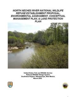
The U.S. Fish and Wildlife Service (Service) proposes to establish a new National Wildlife Refuge in East Texas along a 38 mile reach of the upper portion of the Neches River dividing Anderson and Cherokee Counties. According to the Preliminary Project Proposal approved in 1988, the refuge would be approximately 35 miles south-southeast of Tyler and 100 miles southeast of Dallas. The proposed refuge is located on both sides of the Neches River and includes overflow bottomlands and adjacent pine and pine/hardwood forests.
Refuge Purposes – Should the Service establish the Neches River National Wildlife Refuge, the purposes of the refuge would be to: (1) protect nesting, wintering and migratory habitat for migratory birds of the Central Flyway; (2) protect the bottomland hardwood forests for their diverse biological values and wetland functions of water quality improvement and flood control assistance; and, (3) provide for compatible wildlife-dependent recreation opportunities in accordance with the National Wildlife Refuge System Improvement Act of 1997.
Attached document published March 2005
The U.S. Fish and Wildlife Service is the oldest federal conservation agency, tracing its lineage back to 1871, and the only agency in the federal government whose primary responsibility is management of fish and wildlife for the American public. The Service helps ensure a healthy environment for people by providing opportunities for Americans to enjoy the outdoors and our shared natural heritage.
Wilderness Stewardship Plan Handbook
posted Mar 27, 2024
The purpose of the Wilderness Stewardship Plan Handbook 2014 is to provide direction for creating wilderness stewardship plans, driven by the concept of preserving wilderness character. The Handbook focuses on how to incorporate wilderness policy and wilderness character into a wilderness stewardship plan and also offers a general overview of planning and compliance to be useful for those with and without a professional background in planning.
Ice Age National Scenic Trail: Trail Stewardship Notebook
posted Mar 27, 2024
The Ice Age National Scenic Trail (NST) is a thousand-mile footpath highlighting Wisconsin’s renowned Ice Age heritage and scenic beauty. The Ice Age Trail Alliance (IATA) and its partners can shape users’ experiences. As stewards of the land and the Trail, we can help users develop a connection with the land and create a sense of wonder — even pique their curiosity enough to further explore the Trail.
National Park Service − Rivers, Trails and Conservation Assistance Program
posted Mar 3, 2023
This publication is designed to inform the reader about the services provided by the National Park Service – Rivers, Trails and Conservation Assistance Program.
National Wildlife Refuge System Land Protection Project
posted Jul 29, 2020
The U.S. Fish and Wildlife Service, along with our partners, is charting a course for the future of the National Wildlife Refuge System.
381 views • posted 07/29/2020