The Crown Zellerbach Trail (Crown Z) is a former logging trail through rural areas of Columbia County that connects to the Banks-Vernonia State Trail in Vernonia.

Designated in 2023
• View more details for this trail
in the NRT Database
• Learn about the NRT Program.
The trail starts in Scappoose on the Multnomah Channel at Chapman Landing and transverses through the forested areas of Columbia County to Vernonia Lake. Multiple trailheads are located along this scenic 23-mile trail, from the Chapman Landing Trailhead in Scappoose to the Holce Street Trailhead in Vernonia.
The Crown Z Trail is a partially paved, partially gravel linear trail, perfect for recreational fun during any season. Walking, hiking, horseback riding, or biking are all options at various points in the trek. Certain trailheads offer parking and picnic areas, public restrooms, and bicycle repair stations for visitors to use at their leisure.
Recreation may be the main purpose of this trail, but there are plenty of educational opportunities also. Throughout its length, there are 23 interpretive kiosks and 60 signs that highlight why this trail is special. The kiosks and signs highlight the local history, geology, and wildlife at or near their location and convey the information with photographs and graphics. History topics range from indigenous peoples to apple orchards.
The Crown Z Trail owes its existence to the railroad built to transport harvested timber. Consequently, logging and railroad operations and the people who worked in the forests were frequent subjects. Family pictures and stories were collected to illustrate the diversity of the people who lived along the trail during that era. Minority workers provided special skill sets and were responsible for specific jobs. Japanese laborers were an important component of the railroad operation and the life of one family is explored in detail.
There are six geology interpretive signs that sequentially travel back millions of years to help visitors understand the effects of the powerful ancient rivers of molten rock that flowed from Idaho and massive glacial floods from Montana which created the land formations they see today. Natural history signs describe and picture local wildlife and plants.
The trail follows the drainages of two local creeks which originate at the Nehalem Divide, the highest point of the trail but one of the lowest passages crossing Oregon's Coastal Range. Its easy topography made it a likely trade route between the Chinookan Indians who lived along the Columbia River and the Clatskanie Indians whose range extended into the Nehalem Valley at the far end of the trail. By 1905, it became the obvious route for one of Oregon's first logging operations to build a rail line for hauling huge logs to the Columbia River where they could be easily floated to lumber mills. The railway was sold to the Crown Zellerbach Corporation in 1945 and later converted to a wide logging truck road. After the road fell into disuse, Columbia County acquired the right of way. The trail was opened to the public in 2014 and retains both the gentle grade of the rail line and the width of the subsequent logging road. The gravel path is more like a firm forest floor in most places allowing hikers, mountain bikers, and equestrians to immerse themselves in the surrounding forest and farmlands. Many sections of the trail are even suitable for road bikes.
The Crown Z Trail is a Columbia County park managed in cooperation with the cities of Scappoose and Vernonia. Download the trail brochure here.
Photos by Columbia County Parks and General Services
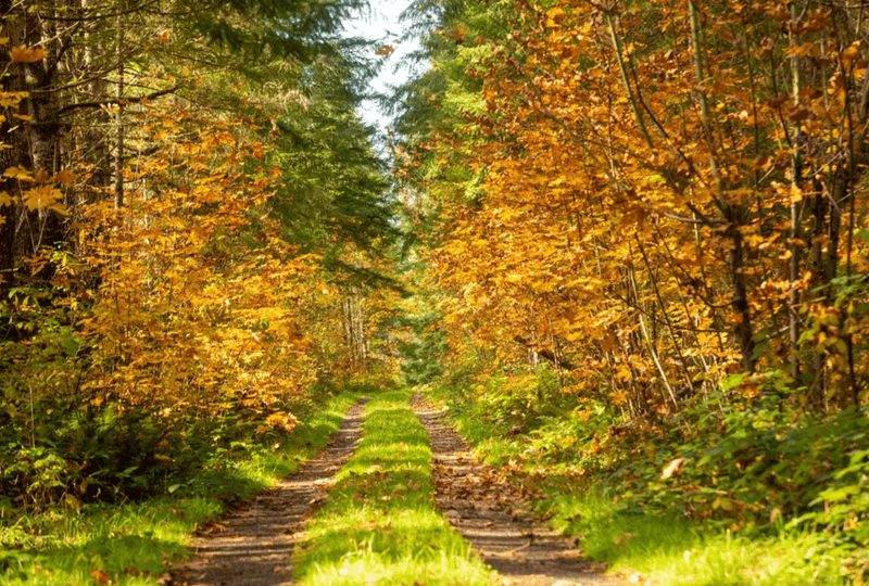
Fall colors on the Crown Z
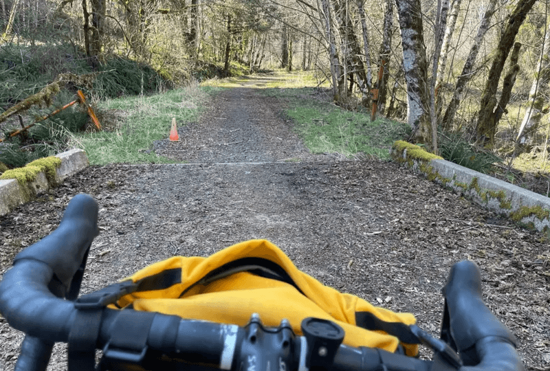
View through the handlebars
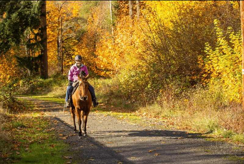
Horse and rider enjoying a fall day on the Crown Z
Blackstone River Bikeway, Rhode Island
posted Apr 14, 2024
The Blackstone River Bikeway takes you through the heart of the Blackstone Valley. Peddle past historic mills, workers housing, the Blackstone Canal, the Providence and Worcester Railroad, and the Blackstone River itself.
Twenty Mule Team Trail, California
posted Mar 17, 2024
For many people, nothing symbolizes Death Valley more than the famous Twenty Mule Teams.
Hillman Heritage Trail, Kentucky
posted Mar 17, 2024
Located in Hillman Ferry Campground, portions of the trail follow a long-abandoned road that once carried old cars, wagons, and horses to the Tennessee River at Hillman Ferry.
Desert Ecology Trail, Saguaro National Park, Arizona
posted Feb 19, 2024
Located in the Sonoran desert, this paved interpretative, signed trail gives an overview of the plants, animals, and weather encountered in the desert.
447 views • posted 10/24/2023