Vision is to create a recreational trail stretching the entire 336 miles of the Central Arizona Project (CAP) canal.
Designated in 2003
• View more details for this trail
in the NRT Database
• Learn about the NRT Program.
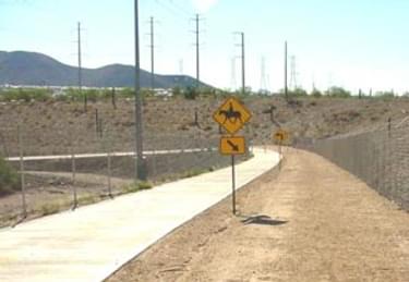
The Central Arizona Project (CAP) Trail is a 32-mile shared-use trail (currently under construction) that is part of a larger vision to create a recreational trail stretching the entire 336 miles of the Central Arizona Project canal. The trail serves a broad population and represents a key link to major trails in Pima County and the Tucson metro area. Residents enjoy close-to-home outdoor activities such as hiking, mountain biking and horseback riding. The CAP project is one of several cross-state trails planned for various regions of America.
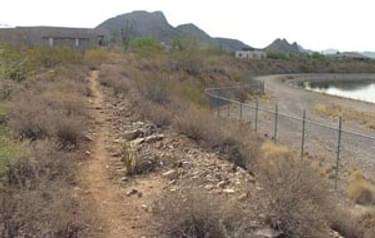
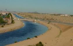
A big concept in the planning stages would use the right-of-way of the Central Arizona Project (CAP) from the California state line to Tucson. The 336-mile route is a major water supply from the Colorado River near Lake Havasu to farms and homes across urban Arizona. The canal is owned by the U.S. Bureau of Reclamation. Officials in Pima County have begun work on a master plan for a 55-mile section of the CAP Trail. Other jurisdictions will be looking at the plan as a model for their own stretches of the trail.
Recently the City of Scottsdale held a public meeting to discuss the trail system, bringing together representatives of several cities, the Bureau of Reclamation, the Central Arizona Water Conservation District, Arizona Dept. of Transportation, and Maricopa and Pima Counties.
Adjacent land uses have also been cooperators in developing the CAP Trail. For instance the Sanctuary Golf Course in Scottsdale has developed a multiuse trail system along the golf course which borders the CAP canal. Pathways totaling three miles are maintained by the golf course staff and regulated by the city's trails department.
Facilities along the CAP Trail include the Sandario Trailhead has spaces for 18 cars and 5 horse rigs, and was constructed by Pima County using funding from the U.S. Bureau of Reclamation and the Arizona Trails Heritage Fund grant program. Pima County maintains the trailhead.
Blackstone River Bikeway, Rhode Island
posted Apr 14, 2024
The Blackstone River Bikeway takes you through the heart of the Blackstone Valley. Peddle past historic mills, workers housing, the Blackstone Canal, the Providence and Worcester Railroad, and the Blackstone River itself.
Twenty Mule Team Trail, California
posted Mar 17, 2024
For many people, nothing symbolizes Death Valley more than the famous Twenty Mule Teams.
Hillman Heritage Trail, Kentucky
posted Mar 17, 2024
Located in Hillman Ferry Campground, portions of the trail follow a long-abandoned road that once carried old cars, wagons, and horses to the Tennessee River at Hillman Ferry.
Desert Ecology Trail, Saguaro National Park, Arizona
posted Feb 19, 2024
Located in the Sonoran desert, this paved interpretative, signed trail gives an overview of the plants, animals, and weather encountered in the desert.
3,555 views • posted 03/27/2018