From the Mid-Peninsula Open Space District
A comprehensive document to guide use policies and regulations for a large suburban trail system south of the Bay Area.
One of the District's basic policy statements is that it will "follow a land management policy that provides proper care of open space land, allowing access appropriate to the nature of the land and consistent with ecological values." As a result of the rapidly increasing level of trail use and the increased types of trail use, it is necessary to adopt more specific policies on trail use in order to effectively implement this basic policy statement.
The District is concerned both with the safety of all trail users and the enjoyment of their open space experience. The purpose for which people use open space trails varies depending on individual or group needs. Visitors may come to observe nature in a protected environment, experience tranquility, exercise in a non-urban setting, or any combination of these. The means by which visitors use trails also varies— be it hiking, running, on bicycle, on horseback, or in a wheelchair. Motorized vehicles, except electric wheelchairs are prohibited.
The combination of trail conditions, level of use, and the mix of uses may lead to conflicts. Conflicts result in negative environmental impacts, unpleasant user experiences or unsafe situations. Conflicts are related to several factors, including:
The relative speeds of different users. Existing trail conditions, such as poor line-of-sight, narrowness, steep slopes and wide-open stretches of trail that might encourage excessive speed . A lack of knowledge of, or disregard for, trail use etiquette and regulations by all types of users. A high concentration of use in certain areas.
This set of policies is intended as a guide in establishing trail use designations throughout the District which will promote safe and enjoyable experiences for all who use the District lands. These policies are not intended to restrict who may use the District trails, but they may restrict how or under what conditions the trails are to be used.
1.0 The District will endeavor to provide a variety of satisfying trail use opportunities on open space preserves throughout the District. More specifically, the District will endeavor to:
1.1 Provide multiple use on individual trails where such use is consistent with the balance of these policies.
1.2 Protect the opportunity for tranquil nature study and observation, especially in those areas identified as providing a unique wilderness experience.
2.0 The District will designate appropriate use(s) for each trail. Uses will be allowed that are consistent with District's objectives for sound resource management and safe and compatible use. More specifically, the District
2.1 Allow trail use appropriate to the nature of the land and consistent with the protection of the natural, scenic and aesthetic values of open space.
2.2 Within budgetary and staffing constraints, make reasonable efforts to provide safe conditions for trail users.
Evaluate trail user needs, concerns, quality of experience, impacts, and the compatibility of various uses. Those uses creating the least conflict among trail users and the least environmental impact will be given greatest preference in trail use planning.
2.4 Ensure that all District trails will be accessible to hiking. When consistent with this policy, if a non-hiking use adversely impacts user safety, the use may be restricted or redirected. The intention is not to restrict access by any individual, but rather to limit incompatible uses and means of travel.
3.0 The Board of Directors will adopt qualitative and quantitative trail use guidelines to aid the Board and staff in determining trail use designations in the implementation of these policies.
4.0 Specific trail use designations will be established and reviewed periodically through the Use and Management Planning Process, and will be subject to adopted Public Notification Procedures. Trail use designations may change if use patterns develop that are in conflict with these policies.
4.1 In extreme cases where there is not sufficient time to comply with the Use and Management Planning Process, the Board of Directors or General Manager may make an interim decision to limit use while providing an evaluation process and timeline for final determination of the designated use.
5.0 The District will endeavor to provide trail access for a variety of physical capabilities and user needs (including persons with physical limitations) in a manner consistent with resource protection goals, budgetary constraints, and state and federal regulations.
6.0 The District will carry out management programs necessary for the implementation of these trail use policies. The designation of appropriate trail use as a method of minimizing trail use conflicts and environmental impacts will require a significant increase in trail use measures such as education, physical improvements to trails and enforcement of trail use regulations. More specifically the District will:
6.1 Support trail use actions with a strong educational program. The District recognizes that education in proper trail etiquette and low impact use is a key measure towards the reduction of negative trail use impacts.
6.2 Monitor trail use conditions on a regular basis. The purpose of a monitoring program will be to evaluate current conditions and to determine whether or not trail management programs, including maintenance, reconstruction, education and use regulations are effective in addressing user conflicts and environmental impacts, and to recommend changes if necessary.
6.3 Include implementation costs in determining the feasibility of trail use designations and regulations.
7.0 The District will work with other agencies, interest groups and private landowners in an effort to promote an interconnecting trail system throughout the region. The District recognizes that connections should be compatible with other jurisdiction designations and land owner objectives as well as these policies and trail use guidelines.
8.0 The District recognizes that existing trail use characteristics such as the types of use, conflicts, and impacts may change over time so that certain policies may no longer be appropriate or a new policy may be required. Hence, these policies will be subject to review and revision as deemed necessary by the Board of Directors, following adopted Public Notification Procedures .
What are trail use guidelines?
Trail use guidelines are quantitative and qualitative factors considered in determining trail use designations. Quantitative factors include physical characteristics of a trail such as trail width and grade, line-of-sight and side slopes. Qualitative factors are more subjective in nature and address existing trail use conflicts, other preserve activities, trail use on adjacent lands, and past, present and future trail use.
Trail use guidelines are designed to assist the District staff and Board of Directors in implementing adopted trail use policies. The guidelines are meant to be principles that direct the judgement and decision making process. They are intended to provide flexibility in the planning and management of the District's trail system. The District is currently developing accessibility plans that comply with the Americans with Disabilities Act (ADA). As part of the process, trail access for visitor's having disabilities is being addressed. When completed, trail use considerations contained in the ADA Plan will be incorporated into the trail use guidelines.
Why are trail use guidelines being developed?
Trail use guidelines are being developed to comply with the existing Trail Use Policies, adopted by the Board of Directors in November 1990. The purpose of the policies is to promote safe and enjoyable experiences for all who use the District lands. Trail Use Policy 3.0 states "The Board of Directors will adopt qualitative and quantitative trail use guidelines to aid the Board and staff in determining trail use designations in the implementation of these policies." As pointed out in the preamble to the policies, this policy is not intended to restrict those who may use the District trails, but they may restrict how or under what conditions the trails are to be used (Refer to Trail Use Policies dated November 14, 1990)
How are trail use guidelines going to be used?
Trail use guidelines will be applied to each preserve on an individual basis. A particular trail system will be examined in a comprehensive manner along with all other elements of the preserve's use and management plan. This is to insure that land use decisions relating to such things as environmental education, parking areas and observation platforms become factors in determining appropriate trail use. Use and management plans are reviewed by the Board of Directors in accordance with District's planning process and subject to the Public Notification Procedures.
Trail use guidelines and the planning process
The trail use guidelines are presented in the following table. They are, generally, in the order they will be considered in the use and management planning process. Many of these guidelines can be applied simultaneously during the process.
What are trail class designations?
The District's trail system is characterized by a wide variety of physical trail conditions. These trails range from level to steep, narrow to wide, and with natural features making each trail somewhat unique. Many of the trails, though, can be grouped together when examining similarities in trail width and grade, side slope, and line of sight. In fact, the majority of trails fall into three classes which are described, herein, as Class A, B and C. Together, these three classes are believed to represent approximately 75% of the District's trail system. >P>The four physical characteristics that determine a trail class designation are:
What are trail use conflict mitigation measures?
In the future, increasing trail use and changing modes of travel will escalate trail use conflicts. Trail use guidelines and designations may reduce trail conflicts but will not completely resolve them. Unfortunately, trail users will always have different expectations, irresponsible and illegal trail use will continue, and accidents will happen even under the best conditions. It is, therefore, necessary to employ trail use conflict mitigation measuresa.
Mitigation measures are an array of actions that may be undertaken to augment trail use guidelines and designations. They are essentially the tools used to reduce significant trail use conflicts to an acceptable level.
They vary greatly in their scope and application and therefore need to be evaluated on individual merit. These tools include such things as educational videos, bicycle helmets and one-way trails. Generally speaking, mitigation measures can be grouped into the following five categories.
What mitigation measures have been undertaken to date?
How are mitigation measures going to be employed?
Many trail use conflicts are related to physical conditions of a trail and levels of trail use. Each situation where conflicts occur may be unique and require individual attention. Other situations may be widespread and mitigation measures can be applied more broadly. In other words, bicycle helmets may be considered appropriate District-wide while one-way uphill trails may be developed in specific areas of a preserve.
The mitigation measures that have been addressed in the attached table can be considered a shopping list when trying to resolve specific trail use conflicts. Some mitigation measures may not be the panacea they first appear to be. Without fully understanding the relative effectiveness of a measure and budgetary impacts, it may be premature to consider implementation. The purpose of compiling the comprehensive list is to understand the multitude of available tools and weigh their individual merits. Many of the measures will require further evaluation and Board consideration before they can be implemented. On the other hand some measures can be more easily implemented when they are relatively effective and do not require detailed fiscal analysis.
What is included in the Mitigation Measures table?
The following table includes an analysis of mitigation measures that have been identified during the course of this study. The left portion of the table represents comments expressed by the public, staff, and Board committee. Comments are not necessarily supported by each and everyone who participated in the planning process. They are presented to fairly represent those who have commented and believed to add valuable insight into the planning process.
The right portion of the table represents the Board committee's view (based on staff input) of the resources, complexity and relative effectiveness of each measure. The first four columns project the staffing levels that may be needed in respect to planning, operations, public affairs and administrative programs. The fifth column indicates the potential cost that may be associated with materials, publications and contract services. Cost projections do not include staff salaries which are indirectly included in staffing levels. The implementation column represents the complexity and time that may be involved in implementing a particular measure. The seventh column projects the amount of volunteer support and commitment necessary. The last column, and most subjective part of the analysis, is an opinion of relative effectiveness of a measure in respect to other mitigation measures in the table.
Most of the 200 miles of trails in the 23 open space preserves of the. Midpeninsula Regional Open Space District are dirt roads and paths that already existed when the District acquired the properties. Each week, thousands of visitors of various ages and abilities including hikers, runners, bicyclists, equestrians, dog owners, and people with disabilities use these trails, which vary greatly in construction quality and current condition. With so many types of trails and users, it is crucial that the District determine which trails are suitable for each type or combination of uses, to reduce possible conflicts between different trail users, and help ensure a safe, pleasant experience for all preserve visitors.
Listed below are the policy documents and procedures adopted by the District Board of Directors to guide the trail use designation process. These have been developed over a period of several years with extensive public input from many trail user groups, including many hearings and workshops. These documents are available from the District administrative offices.
Trail Use Policies. Sets overall goals and policies for balancing and accommodating different types of trail use. Sets basic criteria for evaluating trail use, and responsibilities for implementation.
Trail Use Guidelines And Mitigation Measures. Provides detailed programs, procedures and general trail classification standards for determining appropriate uses on specific trails. Includes an extensive list of measures (limitations, modifications, education, enforcement) that may be applied to allow particular uses that might otherwise be physically unsuitable for a specific trail.
ADA Plan. Prepared in response to the Americans with Disabilities Act of 1990. Sets policies and goals for accommodating persons with disabilities: removing barriers, evaluating design standards, and publishing information on access conditions.
Preserve Use & Management Plan (U & M Plan). Prepared for each preserve or site. Typically starts off as a brief document at the time of acquisition, describing the existing conditions, sensitive resources, and potential hazards, and designating access on existing roads and trails as appropriate. Public use is usually light until parking and other amenities are provided. Based on an overall schedule, the District revisits the plan for each preserve in detail, to identify opportunities for new trails, parking areas, restrooms, and needs for special management or restoration actions.
Trail Element Update. Part of the detailed U & M Plan, a Trail Element contains the description and use designations for existing and proposed trails. The District is in the process of preparing or updating Trail Elements, starting with the most popular or emphasized preserves, in order to apply the recently-adopted Trail Use Policies and Guidelines. It is in the Trail Use Element that the final decisions are made about which uses should be allowed on each trail.
Target Use And Management Review Schedule. Shows the expected timing for review of the U & M Plan and/or Trail Element for each preserve over a five year period. It is updated annually around the end of the calendar year.
Site Emphasis Plan. The capital improvement plan (C.I.P.) for new construction over the next five years, including new or reconstructed trails. Updated annually at end of calendar yea, and incorporated into the annual budget and work program.
posted Apr 17, 2024
This report summarizes guidance and best practices to create safer bicycle facilities and connect them into networks that allow more people to safely bike to more places within and throughout communities.
Setting Speed Limits for Health and Safety
posted Apr 17, 2024
This mini-report on setting speed limits shows the current framework for speed limit policies through a review of state laws that set speed limits.
posted Nov 14, 2023
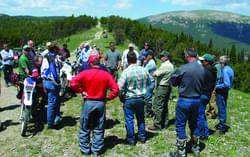
These case studies reveal a number of lessons learned that will be valuable in future winter travel management planning efforts.
TRAILS SAFE PASSING PLAN: STOP, SPEAK, and STAND BACK
posted Feb 14, 2023
Horses are prey animals and naturally can be afraid of unfamiliar people and objects. Horses have natural "flight“ survival instincts and prefer to move their feet towards an exit route. Therefore, people with horses should pass at a walk while other trail users remain STOPPED until passed.
1,257 views • posted 05/30/2018