From the Tahoe Rim Trail Association
The Tahoe Rim Trail is a 170 mile scenic backcountry non-motorized trail system looping along the ridgeline surrounding Lake Tahoe. It consists of the Tahoe Rim National Recreation Trail (120 miles) on the East, North and West sides of the lake, and 50 miles of the Pacific Crest National Scenic Trail on the West and South.
Designated in 2003
• View more details for this trail
in the NRT Database
• Learn about the NRT Program.
The trail offers spectacular views of the lake and surrounding mountain peaks, forests and meadows. It winds through (California and Nevada, six counties, three national forests, and state park land. The trail exists because of the dreams and dedicated efforts of thousands of volunteers to plan, build and maintain the trail in cooperation and coordination with the US Forest Service and Nevada State Parks and other private and public entities.
Trail construction was begun in 1984 and completed in the fall of 2001. This multi-use trail is open to hikers, equestrians, and in many areas, mountain bikers. The trail offers recreational opportunities for locals and visitors to the popular Lake Tahoe area, which lies within a 45 minute drive from Reno and Carson City, Nevada and within a 2-4 hour drive from the millions of people who live in Sacramento and the San Francisco Bay area in California.
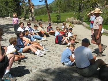
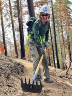
Access to the trail is provided by multiple trailheads throughout the basin, and information and interpretation of the trail and associated resources can be found at the trailheads, visitor centers and many outdoor shops throughout the area. The Tahoe Rim Trail Association (TRTA), with the support of its members and volunteers, will be the trail steward and caretaker for generations to come. Since its inception, over 10,000 volunteers have given over 400,000 hours to build and maintain this magnificent public resource.
Another key partner for the TRTA is the Pacific Crest Trail Association (PCTA). The TRT shares 49 miles of the Pacific Crest National Scenic Trail (PCT) in order to connect the TRT loop around Lake Tahoe. The TRTA has pledged to maintain the trail section shared with the PCT. Both organizations have been working together to ensure each trail is recognized as a national treasure and to maintain the integrity of the separate trails which incur different recreational uses.
The TRT project is a special example of a collaborative effort between public agencies and a non-profit organization, which oversees the trail project. In a very sensitive ecological and cultural area, such as Lake Tahoe, these efforts have taken many years. The partnerships that have formed in order to build this trail are an outstanding example of cooperation.
Starting at the Tahoe Meadows Trailhead, at Hwy 431, the trail travels south for 21.8 miles through National Forest and Nevada State Park land. The trail winds through a fairly dry and sometimes sandy forest with many clear, open views of the Lake Tahoe basin and the northern Great Basin. Passing by Twin Lakes, 2 miles from Marlette Lake and .5 mile from Spooner Lake this section of the trail is a visual history lesson of the Comstock mining era. This section of the TRT has been adopted as part of the American Discovery Trail.
After crossing Hwy 50, the trail continues south for 12.2 miles up through thick forests and out to an open, grassy ridge with expansive views of Lake Tahoe. The terrain continues to be dry and rocky and follows the ridges to eventually cross Hwy 207. From there, the trail passes by Heavenly Ski resort and is quickly ensconced in the forest. Traversing for 22.8 miles, the trail follows the spine of the Carson Range from open meadows to cool pine forests and windswept mountain passes. Breaks in the trees offer panoramic views of Lake Tahoe and the Carson Valley. Hemlock-ringed Star Lake, 8 miles from Kingsbury, is popular for camping and fishing.
The trail crosses Hwy 89 at the Big Meadow Trailhead and gently traverses rolling landscape for the next 5 miles curving through the dense forests and ancient lava flows of the Upper Truckee River Basin. Wildflowers carpet broad meadows, and shallow lakes beckon fishermen and picnickers. The East section of the Tahoe Rim Trail ends at the connection with the Pacific Crest National Scenic Trail in Meiss Meadows.
Beginning at the Brockway West Trailhead at Hwy 267, the trail travels west and south for 19 miles, meandering through aspen and conifer woods dotted with open hillsides that give rare but spectacular views of Lake Tahoe and the peaks lining the north shore. The cool, wildflower-fringed banks of Watson Lake and Creek (6 miles from Brockway) are refreshing spots for fishing and picnicking.
The trail then enters Tahoe City, crossing the only outlet to Lake Tahoe, the Truckee River. From Tahoe City, the trail winds through the forest to Page Meadows, an interlocking series of high alpine meadows. Then following Ward Creek to its headwaters, the trail passes a small seasonal waterfall which is an excellent spot for photos or a picnic. Climbing through granite Ward Canyon, brilliant with wildflowers, to glorious views on the crest of the Sierra, the Tahoe Rim Trail - North ends at Twin Peaks just before the junction with the Pacific Crest National Scenic Trail.
For more information contact the Tahoe Rim Trail Association.
Blackstone River Bikeway, Rhode Island
posted Apr 14, 2024
The Blackstone River Bikeway takes you through the heart of the Blackstone Valley. Peddle past historic mills, workers housing, the Blackstone Canal, the Providence and Worcester Railroad, and the Blackstone River itself.
Twenty Mule Team Trail, California
posted Mar 17, 2024
For many people, nothing symbolizes Death Valley more than the famous Twenty Mule Teams.
Hillman Heritage Trail, Kentucky
posted Mar 17, 2024
Located in Hillman Ferry Campground, portions of the trail follow a long-abandoned road that once carried old cars, wagons, and horses to the Tennessee River at Hillman Ferry.
Desert Ecology Trail, Saguaro National Park, Arizona
posted Feb 19, 2024
Located in the Sonoran desert, this paved interpretative, signed trail gives an overview of the plants, animals, and weather encountered in the desert.
1,818 views • posted 03/27/2018