A presentation on the emergence and growth of the greenway and open space system in Denver, Co.
Many of our brightest ideas turn out to be new discoveries of old ones. Concepts like "greenbelts" and "emerald strands" come from our profession's early visionaries, but have taken on a new importance in the face of development pressure and recreation trends.
We have all seen examples of the classic greenway-- restaurant tables along the San Antonio River Walk, pastoral landscapes of the Hudson River Greenway, and the multiple trails of the American River Greenway in Sacramento. But these corridors are far from a decorative touch to our city centers. The need to revitalize city centers has brought an interest in riverfront, open space, and natural areas preservation; a national commitment to fitness has increased the numbers of people out on trails; and new concepts in mobility are bringing greenways into the mainstream of transportation.
Our current concept of "greenways" is a vision beyond the parks, plants, and visual aspects of the past; now, greenways encompass transportation, urban wildlife, flood control, utilities, education, neighborhood planning, and other threads of the urban fabric. Creating new greenways means understanding the dynamics of many types of corridors, and learning to take advantage of opportunity. Because trails and greenways connect diverse and incompatible land uses, they bridge the isolation of car-based planning and architectural monuments. Yet, the difficulty of trail projects comes from their most attractive feature: linearity.
Why is there currently such a wide interest in greenway and urban trail development? These are the dynamics that are driving this movement nationwide:
Just as our urban parks are no longer the domain of the parasol-carrying gentility, urban trails are lined with more people doing more things. We have seen the demographics of all outdoor activities expand to include more families, more middle-aged and elderly, and more people with a variety of disabilities. As the variety of trail users has increased, so has the diversity of activities on trails. On backcountry trails one new use, the mountain bicycle, is now more common in many areas than the traditional hikers and equestrians. Innovations like the use of llamas to carry supplies for backpackers are bringing still further changes.
On urban trails, a spirit of inventiveness characterizes new activities. One small piece of technology, the quiet, free-rolling plastic wheel, has produced skateboards, in-line skates, and wheeled trail "skis." Big bicycle-type wheels bring children onto trails in buggies pulled by a parent's bicycle and in "racing strollers" pushed by a jogging adult.
Variations on the mountain bike are also bringing more people out on the greenways. The bicycle boom of the 1960s and 70s was based on the now-familiar ten-speed. Designed for racers and long-distance touring, these bikes were ill-suited to the average person and most of the millions sold became garage clutter. The new bikes may never see dirt, much less a mountain, but their upright handlebars, handy brake levers, and sturdy tires make them the vehicle of choice for trail riding.
Two opposite responses have greeted these new users. The negative reaction sees user conflict and seeks to ban everyone but pedestrians. Positive approaches to multiple use are to build more trails, to design them with realistic width, gradient, and sightlines, and to include both paved and unpaved trails in a greenway corridor. The mixture of uses is not a purely physical problem, and trail managers are promoting road-like signing, standards of behavior for users, and appropriate combinations of enforcement and education.
The accepted design for urban trails is a 10 to 12' width of concrete built to bikeway standards providing an all-weather surface for walkers, wheelchairs, bicycles, and other wheeled uses. An adjoining 4 to 8' of smoothly graded earth or crushed rock accommodates runners, horses, birdwatchers, and others who wish to be off the higher-speed paved trail. A primitive natural-surface trail in the same corridor for horses, mountain bikes, or fishermen may also be provided.
Greenways and urban trails have become part of major corridor planning efforts and the catalyst for far-reaching programs of open space preservation. But beyond the rivers and parklands are several other kinds of corridors in which trails and recreation can be included. Examples are rail lines and other transportation rights-of-way, utility corridors, and irrigation and flood control waterways. Trails and greenways are also a way of mixing uses and bringing together unrelated developments. We rarely have a chance to plan a Greenbelt, Maryland, but we do have a chance to influence comprehensive planning, and greenways or multi-use corridors are important tools.
As city and state governments struggle to fund a crumbling infrastructure, parks and recreation are rarely seen as priorities. Why not include trails in these utility and transportation projects to provide more services at less cost in one corridor? In northern Virginia the Washington & Old Dominion Trail is a good example. The line was originally a railroad and, upon abandonment, the electric utility acquired it for a power line route. Later a paved trail and a sewer line were built with the regional park authority managing the surface and recreation activities. Then in 1986 an agreement was reached with AT&T to install fiber optics cables along 35 miles of the trail. The $250,000 annual lease pays for trail maintenance and makes an important contribution to the park district's operations.
Beyond the utility interests, greenway projects provide an opportunity to involve many other diverse partners. In fact, creating an in-depth partnership may be the only way to solve the complex problems of multiple jurisdictions, as well as dealing with the inevitable web of utility and transportation lines. The opportunity for greenway planners is that funding, support and publicity can be greatly broadened by involving partners with more diverse interests.
One example in the Denver metropolitan area centers on Chatfield State Park, which saw 133,000 trail users in 1992. Several major greenway trails come together at the park, which presents an opportunity for an important regional trailhead and improved trail connections for the 27-mile system. Major partners are Martin Marietta Astronautics Group, the South Suburban Park Foundation, Colorado State Parks, and U. S. Army Corps of Engineers, the landowner and operator of the reservoir at Chatfield State Park. The project also includes:
- historic and environmental interpretation;
- a new facility for the Thorne Ecological Institute;
- "Watchable Wildlife" facilities funded by the Colorado Division of Wildlife;
- wetlands restoration;
- fishing access and education opportunities;
- bridges linking trails along Denver Water Department canals;
- access for the disabled to trails and other facilities.
The Chatfield Greenway Plan is being developed by Robert Searns, principal with Urban Edges, Inc., of Denver, who has designed a variety of greenway systems around the country. Other cooperators in the project are the adjacent Highlands Ranch community, the Denver Botanic Garden, two county parks agencies, U. S. Fish and Wildlife Service, the Department of Transportation, and a variety of other organizations.
Perhaps the most visible new use of old utility corridors is the rails-to-trails movement. Abandoned railroads have been converted into trail routes in nearly every state, with over 500 projects totalling 6,000 miles. Many of the routes are highly scenic, running along bluffs and rivers, crossing historic bridges, and passing through 19th Century tunnels. The key to success has been recognition of these rail lines as a priceless resource. Wetlands can be restored and endangered species raised in captivity, but once a linear corridor is disassembled among many owners, all the king's lawyers can't put it together again.
Simply maintaining the corridors intact has been a classic test of political willpower and citizen activism. The battle is generally drawn as a conflict of public interest against the property rights of adjacent landowners. In states with little public land, the opportunity for a long distance trail is a compelling argument. Depending on the economy and tax situation, many corridors have been donated to local jurisdictions by railroads or companies who have acquired the lines for their scrap value. In urban areas, a rail line can provide a priceless off-road trail connection. One example is the Capital Crescent rail trail in the Washington, D. C., area running in an arc from Georgetown to Bethesda, Maryland. Work was just started this spring on the 11 mile trail. The purchase price of $21 million, shared by the National Park Service and Montgomery County, should be compared to cost of assembling a corridor as well as to cost of any kind of transportation development. As the old joke says, they're not making land any more; they're certainly not making continuous routes through densely-developed cities either.
The concept is simple: most utilities need a linear corridor. Why not include public use and recreation along with the utility functions, like telegraph lines along a railroad? Too often, though, these projects are monuments of engineering dedicated to one exclusive and phenomenally expensive use, like the Los Angeles River flood control channel. There are proposals to reclaim part of it, but the cost of re-thinking such a single-minded structure is only one of many obstacles. A few creative solutions like Seattle's Freeway Park are well-known, and others, like acres of nursery stock under power lines are familiar. But as with the re-use of abandoned railroads, there are many examples of other utility corridors combined with trails:
- City water mains
- Water storage project aqueducts
- Irrigation canals
- Historic transportation canals
- Flood control projects
- Electric power lines
- Sewer lines
- Fiber optics lines
- Gas and oil transmission pipelines
Typically, a number of utility corridors or uses may be involved in a single greenway project, such as the Ventura River Trail in southern California. Douglas Nelson, project manager for Royston Hanamoto Alley & Abey, noted that using multiple routes within the trail corridor provided the best solution. "The timing was critical for this project," he said. "Many interests came together in agreement on the benefits of the trail." The available corridor is shared by the river, an abandoned railroad, and a freeway, as well as industrial and residential development. The challenge was to use suitable portions of the river levee and the railroad right-of-way while respecting concerns with riparian habitat and flood potential, adjacent oil production areas, and access to neighborhoods and open space while creating an attractive trail useful for both transportation and recreation.
The advantages of using utility corridors for trails and linear parks are many:
- Separation from traffic and noise.
- Combining facilities for economy of development.
- Making utility corridors more attractive.
- Using a potentially divisive barrier as a connector instead.
- Opportunity for public-private partnerships in providing for recreation.
- Better use of valuable urban land by combining corridor functions.
Among the most revolutionary changes in public policy is the Intermodal Surface Transportation Efficiency Act (ISTEA). This law changes the rules for spending $25 billion a year on one of our most basic public services: transportation. It also earmarks funding for several non-highway "Enhancements," including bike/pedestrian facilities and rail-trails. Recognizing the potential for positive change, the ASLA is involved in the Surface Transportation Policy Project which is trying to help professionals as well as the public to understand and take advantage of the opportunities.
There are four critical effects of ISTEA:
- It provides a focus on all modes of transportation, not just roads and cars.
- It provides for flexibility in transportation funding based on local priorities.
- It requires involvement by the public in transportation planning.
- It calls for the integration of transportation and land use planning.
Here are ways that greenways and urban trails can benefit from ISTEA:
1. Include greenways in transportation planning: these major trail corridors form an interconnected system of routes for bicycles and pedestrians.
2. Inter-modal connections: trails can be a link between homes and transit, and transit can bridge the gaps between trail systems.
3. Multi-modal systems: Both road and transit rights-of-way can provide key links in an uninterrupted corridor for trails systems.
4. Corridor preservation: ISTEA mandates a corridor preservation plan from each state. Rails-to-trails projects and rail-banking preserve corridors for future transportation options as well as providing for non-motorized users now.
5. Funding: by making trails part of the transportation system, the door is opened to potential funding from a variety of ISTEA programs, such as air quality/congestion mitigation, bridge improvement, and transit systems, as well as the 10% mandated for Enhancements.
The traditional view of planners was that only bicycle commuters counted as a transportation user. Since according to the 1990 U. S. Census only 0.7% of Americans bicycle regularly to work, bikes could be viewed as insignificant. In fact, only one out of five trips are made commuting to work. The potential is great. A 1991 Lou Harris poll found that 20% of American would commute by bicycle if there were enough bike trails and safe lanes on roadways.
The multi-modal view is that transportation and recreation are not mutually exclusive activities. One consequence of the unpredicted decrease in leisure time is that more people seek to mix their activities. An hour spent biking to work or running errands on foot is an hour of exercise. Commuting, or other utilitarian trips, can become recreation instead of wasted drive time. The motives of people's trips are less important than encouraging options by providing safe and attractive facilities such a greenways. So excepting only closed circuits like running tracks, any trail becomes part of a non-motorized transportation system.
Another combination of recreation and transportation, and a perfect example of multi-modal thinking, is the concept of rails with trails. Since tracks occupy only a small part of the typically 100 to 150 foot wide right-of-way, a trail could logically fit. Fear of liability by powerful, self-insured railroads has kept the idea from wide acceptance. The new trend, however, toward public agency operation of rail commuter services and ownership of the rights-of-way is providing a new opportunity. As one example, the Los Angeles County Transportation Commission is exploring opportunities for trails-with-transit along a potentially vast system of Commission-owned rail corridors.
In 1992 San Diego County agencies completed designs for a multi-use trail along sections of passenger rail corridor purchased from the Santa Fe Railroad. Garbini & Garbini of San Diego was the landscape architecture firm for the project. Rick Garbini notes that "The concept is really basic; the challenge was to work with the traffic engineers to make the corridor more attractive to users." The other concern is the potential danger to bicyclists and pedestrians along the high-speed trains. There have been a number of train-bike fatalities in recent years, but the occurrences are generally at crossings. By comparison, we accept the dangers of bikes and pedestrians along major roads and rely on the symbolic 6" curb to keep vehicles away from children walking to school. Along the main stretches of the rail corridor, various kinds of grade separation, fencing, and vegetation were used to keep trail users away from the trains. A 16' width was proposed for the concrete trail with a minimum 10' of separation from the track centerline. The 80 to 100' wide right-of-way was judged to be adequate for a double-track railroad plus the bikeway.
The pleasure, and utility, of a trail is moving from place to place through a changing landscape. Integrated trails systems help us create more livable communities where the garage-door opener is not the only physical link to the outside world. Our challenge-- as well as our opportunity-- is the myriad of planning and development efforts going on simultaneously. It is not possible to pick up a greenway project as a separate strand. Trails must be woven into the complex systems of the world we are continually recreating.
Some of the ways of including trails and greenways in comprehensive plans are:
- Combining recreation and transportation plans, and combining different modes of travel.
- Linking adjacent subdivisions with non-motorized connections, bike- and walk-ways, and short-cuts that encourage walking and bicycling.
- Providing trail linkages to workplaces and trails near employment centers as well as to residential areas.
- Using major planning initiatives (like Denver's new airport) as opportunities for trail system development.
- Looking at all kinds of corridors; transportation, utility, streams, and drainage as opportunities to include greenways and recreation.
- Working with all varieties of agencies, governments, and institutions to include greenways in planning efforts.
- Looking beyond the movement of people to attract support from environmental, education, and open space preservation interests.
- Promoting trails and greenways as a resource for the future: an investment in more livable communities.
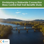
Envisioning a Statewide Connection Mass Central Rail Trail Benefits Study
posted Jun 14, 2023
Study shows completion of the Massachusetts Central Rail Trail System would bring significant health and economic benefits to the commonwealth.
posted May 15, 2023
Mountain Bike Trail Development: Guidelines for Successfully Managing the Process,” a 242-page “how to” manual covers modern trail development from trail types, to landscape analysis and design, to environmental and construction considerations, cost implications and more.
The Beerline Trail Equitable Implementation Plan – 2019
posted Sep 21, 2021
The Beerline Trail Neighborhood Development Project was created to ensure the next phases of trail development serve the needs of the community.
Planning and Managing Environmentally Friendly Mountain Bike Trails
posted Dec 22, 2020
This guidebook can be used to assist in successfully planning, designing, and constructing mountain bike trail systems, while keeping in mind that user issues must be addressed at every stage of development.
283 views • posted 05/03/2018