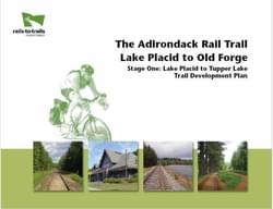
Stage One: Lake Placid to Tupper Lake Trail Development Plan
The purpose of this study is to present options for the development of a recreational and economic resource for the Adirondack region between Lake Placid and Tupper Lake.
by Rails to Trails Conservancy
The 34-mile segment of the Adirondack Rail Trail covered in this report will connect the communities of Lake Placid, Saranac Lake and Tupper Lake (the Tri-Lakes Area) as they have never been connected before. Tourists, seasonal homeowners and permanent residents will all benefit from this rail-trail conversion. The recreational trail will serve young and old, families with small children, persons of all physical abilities, including wheelchair users, nature lovers and history buffs, cyclists, runners, walkers, bird watchers and snowmobilers in season.
In addition to linking three major Adirondack communities, this initial segment of the Adirondack Rail Trail will traverse remarkable countryside and wild lands, skirting the St. Regis Canoe Area on one side and a network of connected waterways on the other. Mountains, wetlands, lakes and ponds abound. The region’s rich history, both natural and cultural, could be highlighted along the way.
When the final segment is completed between Tupper Lake and Old Forge, the 90-mile Adirondack Rail Trail will provide a truly memorable wilderness recreation route — comparable with some of the most successful rail-trails in the country, and all within a day’s drive of 80 million people!
This Trail Development Plan builds upon and refines work performed previously to evaluate the potential for using the nine-mile corridor between Saranac Lake to Lake Placid as a recreational path, and a 2011 study of the costs and benefits of either extending rail service another 25 miles to Tupper Lake or replacing the Lake Placid-to-Tupper Lake corridor with a recreation trail. This trail would be the first step in the development of a 90-mile rail-trail between Lake Placid and Old Forge.
The goal of this study is to define the trail and determine additional steps required to proceed to the design and construction stages.
Attached document published July 2012
Rails to Trails Conservancy (RTC) is a nonprofit organization dedicated to creating a nationwide network of trails from former rail lines and connecting corridors to build healthier places for healthier people.
RTC’s mission, and its value, is magnified in urban areas, where one mile of trail can completely redefine the livability of a community. Where trails are more than just recreational amenities, creating opportunities for active transportation and physical activity—improving our health and wellbeing—as they safely connect us to jobs, schools, businesses, parks, and cultural institutions in our own neighborhoods and beyond.
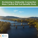
Envisioning a Statewide Connection Mass Central Rail Trail Benefits Study
posted Jun 14, 2023
Study shows completion of the Massachusetts Central Rail Trail System would bring significant health and economic benefits to the commonwealth.
posted May 15, 2023
Mountain Bike Trail Development: Guidelines for Successfully Managing the Process,” a 242-page “how to” manual covers modern trail development from trail types, to landscape analysis and design, to environmental and construction considerations, cost implications and more.
The Beerline Trail Equitable Implementation Plan – 2019
posted Sep 21, 2021
The Beerline Trail Neighborhood Development Project was created to ensure the next phases of trail development serve the needs of the community.
Planning and Managing Environmentally Friendly Mountain Bike Trails
posted Dec 22, 2020
This guidebook can be used to assist in successfully planning, designing, and constructing mountain bike trail systems, while keeping in mind that user issues must be addressed at every stage of development.
576 views • posted 07/29/2020