A Trail Talks Presentation
In this Trail Talk new methods of mobile electronic data collection help streamline assessments for Tennessee State Parks.
System wide trail assessment is a necessary but difficult task for most land agencies to effectively perform. Between dwindling budgets and increased employee workloads, it is difficult to find the time and money to effectively assess what can sometimes be hundreds and even thousands of miles of trail. However using new methods of mobile electronic data collection and streamlined assessments, these large scale tasks are more tangible for agencies with tight budgets and limited staff.
This presentation will share how Tennessee State Parks was able to comprehensively assess its entire trail system by using cloud based spatial data collection and analyzation methods. We will discuss the common problems that systems like yours are facing and the best way to use technology to address those problems.

With the skills I learn at the 2019 International Trails Symposium and Training Institute, I will be able to better plan and execute my large scale trail projects. With the exposure to ideas from a diverse group of people, as well as being able to share my ideas with them and receive feedback, I feel that I will have an opportunity to grow both personally and professionally. In addition, I will have the chance to bring back the skills and knowledge I gain to my organization, therefore multiplying the impact of the Symposium. Through this I hope to continue furthering the conversation about the construction of sustainable trails through new and exciting mindsets.
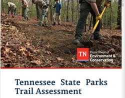
Currently, I am the Trails and Vista Administrator for Tennessee State Parks. I oversee about 1,200 miles of multi-use trails spread across 56 State Parks and 85 Natural Areas. With the support of park staff I help to design, maintain, and construct trails throughout our state’s varied habitats. In my 3 ½ years with Tennessee State Parks I have had the opportunity to participate in many exciting projects that have helped to propel our trails to the next level; from completing a state wide trail assessment using digital GIS cloud-based technology to making a concerted effort to use flexible porous pavement made from locally recycled tires in place of concrete/asphalt for our hard surface trails. I have had the chance to work with a variety of talented people while expanding my understanding of trails and what they mean to people, and I am excited to continue that journey.
posted Oct 4, 2023
The 2002 Hayman Fire grossly affected Trail Creek, a tributary to the South Platte River, with a concomitant increase of sediment yield, increases in significant flood events, and reduced habitat quality.
Assessing and Understanding Trail Degradation
posted Jul 15, 2022
This report describes results from a comprehensive assessment of resource conditions on a large (24%) sample of the trail system within Big South Fork National River and Recreational Area (BSF).
TRACS Trail Assessment & Condition Surveys User Guide 2011
posted Jul 22, 2020
TRACS is an organized approach for collecting and updating field data on trail conditions and the work needed to meet standard.
Trails Assessment and Recommendations for Management
posted May 30, 2018
An Assessment of Trails, Watercourses, Soils, and Redwood Forest Health in Joaquin Miller Park, Oakland, California.
917 views • posted 06/09/2019