posted Jul 30, 2020
The WMBC conducted a survey to target trail users recreating on Galbraith Mountain and elsewhere in Whatcom County. This survey was done entirely online utilizing surveymonkey web-based software.
posted Jul 30, 2020
The purpose of the Jackson Hole Pathways and Trails Survey is to gather public feedback on Jackson Hole’s pathways and trails systems. The results of this first-of-its‐kind survey effort are intended to provide a documentation of pathways and trails usage, satisfaction, strengths, weaknesses, and suggestions for improvement. The information in this report provides solid information to help community decision-makers, stakeholder groups, and interested citizens plan for the future of Jackson Hole’s pathways and trails systems.
posted Jul 28, 2020
by Rails to Trails Conservancy
The 24-mile Three Rivers Heritage Trail extends along the banks of the Allegheny, Monongahela and Ohio rivers in one of America's most storied cities, Pittsburgh, Pennsylvania.
posted Jul 28, 2020
by Rails to Trails Conservancy
Bicycling has exploded around California as people rediscover this enjoyable, healthy, convenient, environmentally friendly and inexpensive way to get around. Many communities are working to create bicycle networks to encourage further increases in bicycling and attract new riders, especially in urban areas. Toward that end, some cities — drawing from successful international models — have experimented with a variety of innovative bicycle facilities not even imagined a decade ago.
posted Jul 28, 2020
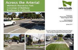
by Rails to Trails Conservancy
Successful shared-use paths offer a continuous and extended recreation and transportation experience. Avoiding vehicular interaction is a major challenge in urban environments where shared use paths intersect the roadway network on a regular basis. In the best cases, the paths are grade separated from roadway traffic with pedestrian bridges or under-crossings. However, geometric constraints, financial resources and incompatible adjacent land uses can require trail planners to contemplate and implement at-grade crossings.

posted Jul 27, 2020
by Rails to Trails Conservancy
Transportation in communities across America is changing with the advent of many small and light personal mobility options, which typically run on electric motors, such as electric-assist bicycles (e-bikes), e-scooters (scooters) and hoverboards. Rails to Trails Conservancy (RTC) offers this perspective to assist communities, trail managers and policy makers in making decisions about how best to manage these devices on nonmotorized multiuse trails.
posted Jul 23, 2020
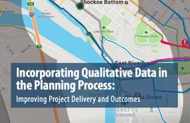
by Federal Highway Administration
This report highlights emerging tools, techniques, and resources for gathering qualitative public and stakeholder input to inform the planning process, improve project outcomes, and contribute to streamlining project delivery.
posted Jul 23, 2020
by Federal Highway Administration
Conducting a simple assessment can be an effective first step in beginning a conversation about how to improve walking and bicycling networks.
posted Jul 22, 2020
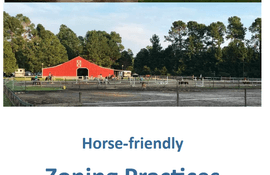
Zoning is very important concept for horse community members to understand, because it effects how and where you may keep your horses, and even how they can be used within a community.
posted Jul 22, 2020
by Federal Highway Administration
Shared paths are paved, off-road facilities designed for travel by a variety of nonmotorized users, including bicyclists, pedestrians, skaters, joggers, and others. Shared-path planners and designers face a serious challenge in determining how wide paths should be and whether the various modes of travel should be separated from each other.
posted Jul 22, 2020
by Federal Highway Administration
The purpose of this guide is to introduce practitioners and others to: 1) the findings of our study on the quality of service on trails; 2) a new analytical tool called the Shared-Use Path Level of Service (LOS) Calculator, and 3) potential implications for trail design.

posted Jul 17, 2020
by Amy Camp with Cycle Forward
by Amy Camp, Principal, Cycle Forward


