
posted Aug 19, 2020
by Michigan Department of Natural Resources, Parks and Recreation Division
The purpose of this plan is to help communities and stakeholders incorporate heritage on the lower reach of the nationally designated Huron River Water Trail (HRWT), from Flat Rock to Lake Erie, which will create a more meaningful trail experience and a greater sense of place.

posted Aug 19, 2020
This toolkit was designed to assist managers in developing and implementing regional or site-specific interpretive plans. It describes each step in the process from the early planning stages through implementation to evaluation.
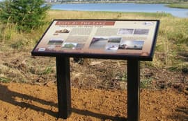
posted Sep 19, 2019
Trails and greenways create an opportunity to teach visitors about history, the environment, and the community
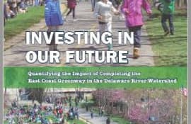
posted Jun 5, 2019
by Niles Barnes with East Coast Greenway Alliance
This report looks at the impact of the East Coast Greenway within the Delaware River Watershed.

posted Feb 19, 2018
This session endeavors to describe multiple projects that are currently bucking this trend- restoring natural systems, providing high quality recreation, and inviting communities back into the woods.
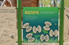
posted Jan 14, 2022
iZone Imaging’s High Pressure Laminate brings to life the interpretive signage throughout the Brawn Family Foundation Bugtopia Playground at the Calgary Zoo. The signs are eco-friendly and can withstand the high traffic interactive area over time. (Sponsored Content)
posted Jun 14, 2021
The Jeffco Trails Plan explores the path ahead for the future of all trails in Jefferson County, Colorado.
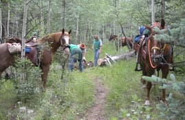
posted May 16, 2018
Increasing numbers of equestrians on public lands require more awareness of impacts.
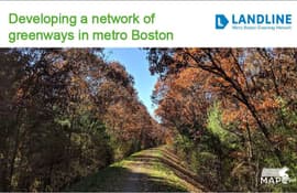
posted Jun 11, 2019
by David Loutzenheiser with Metropolitan Area Planning Council
Learn about how to evaluate an existing trail network to identify projects and opportunities to create a connected trail and greenway network in an urban area.

posted Jun 5, 2019
by Yves Zsutty with City of San Jose - Parks, Recreation, and Neighborhood Services
In this presentation find out what worked and what didn't with San Jose, California's urban trail network.
posted Feb 19, 2018
by Laura Belleville with Appalachian Trail Conservancy, Staci Williams with American Rivers
American Rivers discusses protecting riverside land through the creation of Blue Trails, the water equivalent to hiking trails, and messaging strategies developed as part of the Waccamaw River Blue Trail.
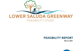
posted Nov 8, 2023
The purpose of the Lower Saluda Greenway, a proposed 10.5-mile multi-use paved path along the north side of the Lower Saluda River, is to increase safe access to nearby parks, trails, and destinations, aid in short-trip multimodal travel, and increase regional connectivity and unity between the Lexington and Irmo areas with the communities of Columbia, West Columbia, and Cayce.


