posted Jul 28, 2020
by Rails to Trails Conservancy
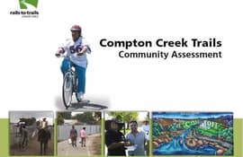
In 2009, Rails to Trails Conservancy (RTC) began a multi-year project to ensure that residents along the Compton Creek bike, equestrian and walking trails were involved in using and supporting their trails, as well as to provide opportunities for programs and activities.
posted Jul 27, 2020
by Mayer/Reed
This manual serves as a technical resource to guide parks and transportation agencies as they plan, design, and fabricate wayfinding signage along regional trails in the Portland-Vancouver metropolitan area.
posted Jul 27, 2020
by Rails to Trails Conservancy
The purpose of this study is to provide a preliminary assessment and concept plan for developing a shared-use path along the New York Avenue corridor within the defined study area. Conducted as the first phase of determining feasibility for trail development, this preliminary assessment did not include extensive stakeholder outreach but can be used to inform future public participation and stakeholder outreach efforts in the next phase of planning.
posted Jul 27, 2020
by Rails to Trails Conservancy
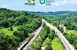
This feasibility study outlines the path forward and the potential in connecting Cleveland and Pittsburgh over 200+ miles of multi-use trails in Ohio, West Virginia and Pennsylvania. The alignment of the 200-miles-plus Cleveland to Pittsburgh (C2P) corridor is primarily made up of existing rail-trails, unused or abandoned rail corridors, and canal corridors.
posted Jul 27, 2020
by Rails to Trails Conservancy
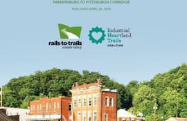
This study focuses on the segment of the P2P corridor that lies within the state of West Virginia, from Parkersburg to the West Virginia–Pennsylvania border, just north of Morgantown. The primary alignment of the P2P corridor utilizes existing rail-trails and unused or abandoned rail corridors, and was largely determined through the collaborative efforts of P2P corridor partners. The size and scope of this project produce inherent complexities that will take many partners—working in coordination over several years—to complete.
posted Jul 23, 2020
by Rails to Trails Conservancy
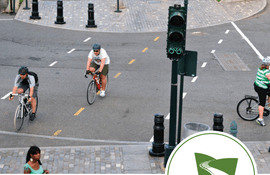
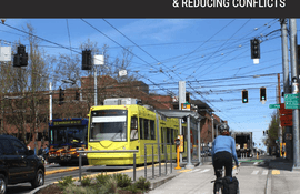
American communities today are at a crossroads. For the past 70 years, the automobile has been the dominant mode of transportation and has received the lion’s share of federal and state transportation investment. Engineers have prioritized maximum car throughput and free-flowing speed or level of service as markers of transportation efficiency and success. Now, communities across America are looking for ways to strike a better balance so that residents might have more transportation choices and a higher quality of life. Multimodal transportation systems that prioritize human-centered mobility are in high demand.

posted Jul 23, 2020
by Partnership for the National Trails System (PNTS)
The Trinity Divide purchase is one of the biggest, single land-acquisition deals ever completed for the Pacific Crest National Scenic Trail
posted Jul 23, 2020
by Federal Highway Administration
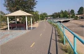
This document highlights case studies of projects that contribute to safe and connected pedestrian and bicycle networks in States and communities throughout the U.S., while at the same time providing resiliency and green infrastructure benefits that promote resiliency and relieve burdens on stormwater systems.
posted Jul 23, 2020
by Federal Highway Administration
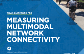
The Guidebook for Measuring Multimodal Network Connectivity is a guide for transportation planners and analysts on the application of analysis methods and measures to support transportation planning and programming decisions. It describes a five-step analysis process and numerous methods and measures to support a variety of planning decisions. It includes references and illustrations of current practices, including materials from five case studies conducted as part of the research process.
posted Jul 23, 2020
by Federal Highway Administration
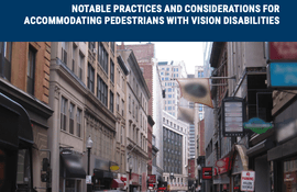
This document reviews notable practices and considerations for accommodating pedestrians with vision disabilities on shared streets. It focuses on streets where pedestrians, bicyclists, and motor vehicles are intended to mix in the same space.
posted Jul 23, 2020
by Federal Highway Administration
This publication is intended to be a resource for practitioners seeking to build multimodal transportation networks.
posted Jul 23, 2020
by Federal Highway Administration
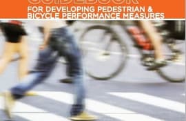
This guidebook is intended to help communities develop performance measures that can fully integrate pedestrian and bicycle planning in ongoing performance management activities.


