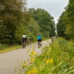
The purpose of this research was to provide a methodology to evaluate how intermodal connections between public transportation and public trails can improve livability in Florida communities.
by National Center for Transit Research (NCTR
This research explored other available methodologies for evaluating intermodal connectivity, developed three case studies of communities outside Florida to compare different approaches, and developed an alternative methodology as applied to the trails and transit systems of Pinellas County and Hillsborough County, Florida.
The research team used data sets and analysis tools that are widely available. The evaluation began by selecting a transportation goal of importance to the community, as defined by a particular travel market and purpose. The home locations of the target traveler market were mapped using a Geographic Information Systems (GIS) spatial analysis with the Environmental Protection Agency Smart Location Database (EPA SLD) and other information sources.
The purpose of the mapping exercise was to discern areas within the counties where larger concentrations of the target traveler market are located. Locations of greater concentrations of the desired trip destination type were determined. Examples of destinations include employment centers, recreation centers, and post-secondary education campuses. The locations of bus routes and bus stops, bicycle and pedestrian facilities, and public trails also were mapped. Study subareas were selected for each county, based upon their location between trip origins and trip destinations.
A trail/transit crossing inventory template was developed and used to conduct audits of the conditions present at selected transit/trail junctures found within the subareas. Recommendations were developed for improvements for each of these transit/trail junctures to make the connections stronger so that someone using nonmotorized transportation could use both public transit and a public trail to complete a multimodal trip to the destination.
We are a program of the Center for Urban Transportation Research (CUTR) at the University of South Florida (USF). NCTR is a livable communities Tier I University Transportation Center funded by the U.S. Department of Transportation (2013-2020). USF has housed a UTC since 1989. We conduct research on all forms of public transportation. We help public transportation professionals and policy makers build strong public transportation systems via education programs to prepare for tomorrow's multimodal challenges and opportunities. We're passionate about helping public transportation agencies improve their performance via technology transfer activities such as webinars and peer-to-peer networks.
posted Apr 17, 2024
This report summarizes guidance and best practices to create safer bicycle facilities and connect them into networks that allow more people to safely bike to more places within and throughout communities.
Making Transportation Planning Applicable in Tribal Communities Research Study: Final Report
posted Dec 20, 2023
The Federal Highway Administration’s (FHWA) Office of Tribal Transportation (OTT) planning staff have observed two challenges in Tribal transportation planning: (1) that existing planning analysis tools do not always align with Tribal community context and needs and (2) it is not always clear what benefits planning provides to transportation project selection and delivery in Tribal communities.
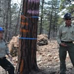
Tribal Development of Trails and Other Dedicated Pedestrian and Bicycle Infrastructure
posted Dec 19, 2023
This white paper provides information and resources for Tribes, Tribal trails and active transportation advocates, and agencies that may partner with Tribes on trail projects including Federal and State agencies, MPOs, county and local governments, and community organizations.
Rails to Trails Conservancy's TrailNation™ Playbook
posted Dec 13, 2023
Rails to Trails Conservancy's TrailNation™ Playbook brings the decades of experience building trail networks across the country to a resource of case studies, best practices and tools for trail network development on a local and national level.
209 views • posted 07/29/2020