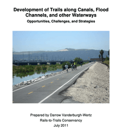
Prepared by Darrow Vanderburgh-Wertz
Shared-use pathways along the banks of irrigation canals, flood channels, and other waterways can serve important recreational and transportation functions. The easy grade, scenic interest, and minimal road crossings make shared-use paths along waterways highly attractive as trails for recreation, transportation, and a healthy, active lifestyle, particularly in urbanized areas.
by Rails to Trails Conservancy
The linear, unbroken character of waterways provide opportunities for shared-use paths of significant length and importance. The 110-mile-long trail located on top of Herbert Hoover Dike surrounding Lake Okeechobee in Florida is a prime example of a levee trail. The Chesapeake and Ohio Canal Trail follows an old canal path along the Potomac River for 184.5 miles and is a fabulous recreational resource for the region. In the more urban environment of Santa Fe, New Mexico, the Arroyo de los Chamisos Trail, which runs along a cement-lined arroyo (wash), provides an important and direct pedestrian and bicyclist connection from densely populated residential neighborhoods into major commercial districts, schools, hospitals and other trails such as the Santa Fe Rail Trail. The Rio Hondo bicycle path in eastern Los Angeles County follows the Rio Hondo, a tributary of the Los Angeles River, and connects residents to schools, community centers, businesses, and regional trails on the San Gabriel and Los Angeles rivers.
There are also some common concerns that arise from cities, trail users, adjacent homeowners, and water districts, such as water security, public safety and maintenance costs. This paper discusses, in brief, the following preliminary considerations as well as strategies to address common concerns that arise in the process of developing a trail along a waterway:
Attached document published July 2011
Rails to Trails Conservancy (RTC) is a nonprofit organization dedicated to creating a nationwide network of trails from former rail lines and connecting corridors to build healthier places for healthier people.
RTC’s mission, and its value, is magnified in urban areas, where one mile of trail can completely redefine the livability of a community. Where trails are more than just recreational amenities, creating opportunities for active transportation and physical activity—improving our health and wellbeing—as they safely connect us to jobs, schools, businesses, parks, and cultural institutions in our own neighborhoods and beyond.
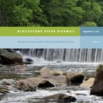
Blackstone River Bikeway (2017)
posted Apr 19, 2024
The Blackstone River Bikeway is a 48-mile-long route connecting Worcester, Massachusetts with Providence, Rhode Island. The Bikeway generally follows the historic Blackstone River and utilizes an off-road multi-use path and an on-road facility.
posted Apr 17, 2024
This report summarizes guidance and best practices to create safer bicycle facilities and connect them into networks that allow more people to safely bike to more places within and throughout communities.
Wilderness Stewardship Plan Handbook
posted Mar 27, 2024
The purpose of the Wilderness Stewardship Plan Handbook 2014 is to provide direction for creating wilderness stewardship plans, driven by the concept of preserving wilderness character. The Handbook focuses on how to incorporate wilderness policy and wilderness character into a wilderness stewardship plan and also offers a general overview of planning and compliance to be useful for those with and without a professional background in planning.
Ice Age National Scenic Trail: Trail Stewardship Notebook
posted Mar 27, 2024
The Ice Age National Scenic Trail (NST) is a thousand-mile footpath highlighting Wisconsin’s renowned Ice Age heritage and scenic beauty. The Ice Age Trail Alliance (IATA) and its partners can shape users’ experiences. As stewards of the land and the Trail, we can help users develop a connection with the land and create a sense of wonder — even pique their curiosity enough to further explore the Trail.
531 views • posted 07/28/2020