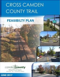
Camden County is undertaking the ambitious goal of constructing a bicycle and pedestrian trail across the length of the county, beginning at the Delaware River waterfront and extending to the southeastern county line, a distance of approximately 33 miles.
by NV5, Inc.
In 2014, Camden County completed a Bicycling & Multi-Use Trails Plan, which identified nearly 500 miles of trails and on-street bicycle lanes that will eventually connect cities, townships and boroughs to create a full network across the county. Camden County currently has about 60 miles of trails and bicycle lanes, but these facilities are typically short segments scattered all across the county.
In order to realize the potential that a robust bicycle and pedestrian network can have, and to keep the momentum of the ambitious Bicycling & Multi-Use Trails Plan moving forward, the county decided to investigate a central route that will serve as the “backbone” of the entire built-out system. Camden County officials envisioned a route that would cut across the county, from the Ben Franklin Bridge in Camden, through various suburban boroughs, to the preserved open spaces in the rural parts of the county. Future trail and bike lane construction would then be able to connect to this central trail, helping to accelerate the build-out of the system.
While one of the major goals of this initial route is to create a recreational trail that will connect to parks and open space, it is also a goal to create a practical route that will encourage daily bicycle commuting and utilitarian trips, such as for getting groceries or going out to eat. The potential tourism component is a significant factor to consider as the route is investigated
Attached document published June 2017

NV5 is a provider of engineering and consulting services to public and private sector clients, delivering solutions through five business verticals: Construction Quality Assurance, Infrastructure, Energy, Program Management, and Environmental.
With offices nationwide and abroad, NV5 helps clients plan, design, build, test, certify, and operate projects that improve the communities where we live and work.
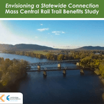
Envisioning a Statewide Connection Mass Central Rail Trail Benefits Study
posted Jun 14, 2023
Study shows completion of the Massachusetts Central Rail Trail System would bring significant health and economic benefits to the commonwealth.
posted May 15, 2023
Mountain Bike Trail Development: Guidelines for Successfully Managing the Process,” a 242-page “how to” manual covers modern trail development from trail types, to landscape analysis and design, to environmental and construction considerations, cost implications and more.
The Beerline Trail Equitable Implementation Plan – 2019
posted Sep 21, 2021
The Beerline Trail Neighborhood Development Project was created to ensure the next phases of trail development serve the needs of the community.
Planning and Managing Environmentally Friendly Mountain Bike Trails
posted Dec 22, 2020
This guidebook can be used to assist in successfully planning, designing, and constructing mountain bike trail systems, while keeping in mind that user issues must be addressed at every stage of development.
308 views • posted 07/28/2020