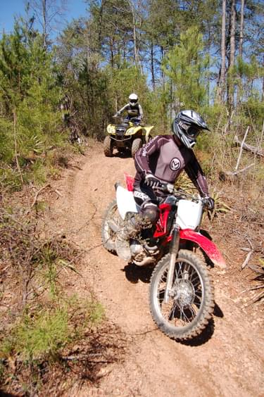
From Bureau of Land Management, Kremmling Field Office
The following criteria are used in order to determine suitable locations for new trails and trail reroutes within the Kremmling Field Office, Colorado

These criteria are to be followed as guidelines. Not all of the criteria can be met on every segment of every trail. Their purpose is to help create sustainable, low-maintenance trails that provide quality recreational experiences based upon predetermined trail management objectives (TMOs). Specialty trails requiring higher maintenance may be allowed in appropriate locations.
1. Know and understand trail management objectives
TMOs provide the framework for what the trail will look like, who will be using the trail, and how the trail will be managed. Different TMOs may allow different applications of the criteria described below.
2. Create loops and avoid dead end trails
All trails should begin and end at a trailhead or another trail. A well-planned stacked loop trail system offers a variety of trail options. Easier, shorter loops are arranged close to the trailhead, with longer, more challenging loops extending further beyond the trailhead. Occasionally, destination trails to a point of interest will require an out-and-back trail, but only if they cannot be reasonably incorporated into a loop.
3. Identify control points and use them to guide trail design and layout
Control points are specific places or features that influence where the trail goes. Basic control points include the beginning and end of the trail, property boundaries, intersections, drainage crossings, locations for turns, and other trails:
Positive Control Points -- Positive control points are places where resource managers want users to visit, including scenic overlooks, historic sites, waterfalls, rock outcroppings, lakes, rivers, and other natural features or points of interest. (If the trail does not incorporate these features, users will likely create unsustainable social trails to get to them.)
Negative Control Points -- Negative control points are places resource managers want users to avoid (such as low-lying wet areas, flat ground, extremely steep cross slopes or cliffs, unstable soils, environmentally sensitive areas, sensitive archaeological sites, safety hazards, and private property).
Sensitive Areas -- Sensitive areas include environmentally sensitive areas, sensitive archaeological sites, safety hazards, and private property.
Knowing these control points provides a design framework. Resource Managers should try to connect the positive control points while, at the same time, avoiding the negative control points.
4. Use cross-slopes and avoid flat ground, whenever possible
Generally, the trail tread should run perpendicular to the cross-slope, and should utilize frequent grade reversals. (This is the best way to keep water off of the trail.) Resource managers should use curvilinear design principles in order to create a trail that follows the natural contours of the topography, sheds water, blends with the surrounding terrain, and provides fun recreational opportunities.
The following grade guidelines will help determine appropriate tread locations:
The Half Rule -- “A trail’s grade shouldn’t exceed half the grade of the hillside or sideslope (cross-slope) that the trail traverses. If the grade does exceed half the sideslope, it’s considered a fall-line trail. Water will flow down a fall-line trail rather than run across it. For example, if you’re building across a hillside with a (cross slope) of 20 percent, the trail-tread grade should not exceed 10 percent” (IMBA 2004). Steeper cross-slopes allow more flexibility for sustainable tread grades, while flat or low angle cross-slopes can be problematic. (There is an upper limit to this rule. Sustaining a 24 percent tread grade, even on a 50 percent cross-slope is unlikely. In addition, trail segments may break this rule on durable tread surfaces, such as on solid rock.)
The Ten Percent Average Guideline -- The average trail grade over the length of the trail should be 10 percent or less, for greatest sustainability. Short sections of the trail may exceed this; however, the overall grade should remain at 10 percent or less.
Maximum Sustainable Grade -- This is the upper grade limit for short trail segments that push the limits of the previous two guidelines. It is determined by a site-specific analysis based upon TMOs, environmental conditions, and observations of existing trails (such as, what’s working, and what’s not?).
Grade Reversals -- Frequent changes in the direction of tread grade (gentle up- and-down undulations) will ensure that water is forced off of the trail at frequent intervals.
5. Locate trails in stable soils
Avoid clays, deep loam, and soils that do not drain rapidly. Consider season of use and type of use. The capabilities of motorized vehicles to function in wet/muddy conditions make it imperative to avoid unstable or poorly drained soils. Trails that are less likely to be used when wet may be located in less-desirable soils, if necessary. (In western Colorado’s arid environment, the best soil conditions for trails are those with high rock content.)
6. Drainage crossings are key control points and should be selected carefully
Resource managers should consider both the trail’s impact on the drainage (erosion and sedimentation), and the drainage’s impact on the trail (changing tread surface, water channeling onto trail). The trail should descend into, and climb out of, the drainage in order to prevent water from flowing down the trail. Trails should avoid long, or steep, entries into drainages. Resource managers should design grade reversals into the trail on each side of the approach in order to minimize water and sediment entering from the trail. Resource managers should look for drainage crossings on rock.
7. Dry washes can be excellent travel ways
Dry washers are well defined, contain noise, and are periodically resurfaced by flowing water. As long as the wash does not support riparian vegetation, and has no major safety problems (such as water falls), they are well suited to be part of a recreational trail system.
8. Avoid switchbacks
Switchbacks are difficult, time-consuming, and expensive to construct, and require regular maintenance. (Users often cut them, causing avoidable impacts.) Using curvilinear design principles eliminates the need for most switchbacks. Climbing turns are easier to construct and maintain, and utilize natural terrain features (benches, knolls, rock outcrops) in order to change the direction of a trail.
9. Avoid ridge tops
Ridge tops are often primary transportation corridors for wildlife, and were often used by Native Americans as travel routes. Noise from ridge-top trails is broadcast over a wide area. In order to isolate noise, resource managers should locate trails on side hills, off of ridge tops, using ridges and watersheds as natural sound barriers.
10. Use vegetation and other natural features to conceal the trail and absorb noise
This can be difficult in a desert environment. Resource managers should try to minimize the visual impact of the trail by following natural transitions in vegetation or soil type. Usually, a trail near the base of a sideslope, or on rimrock, is less visible than a mid-slope trail. Denser vegetation will hide a trail, lessen noise transmission, and can dissipate the energy of falling raindrops on the bare soil of the trail tread.
11. Carefully design intersections to avoid safety problems
When locating a bicycle or motorized vehicle trail, resource managers should be aware of sighting distance and sight lines. (Collisions can be avoided if riders can see each other.) Trails should avoid 4-way intersections. Offsetting the cross-traffic helps to reduce speeds, and reduces the risk of collisions.
Note - Lori Hennings, Senior Natural Resource Scientist with the Conservation Program, Parks and Nature Department of Oregon, sent the following suggestions for further reading:
Avoiding Impacts on Wildlife
"There is a lot of information out there about human disturbance, trails and wildlife. A couple of years ago I gathered that information in this white paper: https://www.oregonmetro.gov/recreation-ecology-literature-review. Turn to pages 91 and 92 for fright distances associated with wildlife under various scenarios of human disturbance."
To learn more about this issue watch Lori Henning's webinar entitled "Using Wildlife Fright Distances to Inform Trail Planning." You can find the recording at this link.
[NOTE: This document uses terminology from the “Recommended Standardized Trail Terminology for Use in Colorado” (COTI 2005).]
Blackstone River Bikeway (2017)
posted Apr 19, 2024
The Blackstone River Bikeway is a 48-mile-long route connecting Worcester, Massachusetts with Providence, Rhode Island. The Bikeway generally follows the historic Blackstone River and utilizes an off-road multi-use path and an on-road facility.
posted Apr 17, 2024
This report summarizes guidance and best practices to create safer bicycle facilities and connect them into networks that allow more people to safely bike to more places within and throughout communities.
Wilderness Stewardship Plan Handbook
posted Mar 27, 2024
The purpose of the Wilderness Stewardship Plan Handbook 2014 is to provide direction for creating wilderness stewardship plans, driven by the concept of preserving wilderness character. The Handbook focuses on how to incorporate wilderness policy and wilderness character into a wilderness stewardship plan and also offers a general overview of planning and compliance to be useful for those with and without a professional background in planning.
Ice Age National Scenic Trail: Trail Stewardship Notebook
posted Mar 27, 2024
The Ice Age National Scenic Trail (NST) is a thousand-mile footpath highlighting Wisconsin’s renowned Ice Age heritage and scenic beauty. The Ice Age Trail Alliance (IATA) and its partners can shape users’ experiences. As stewards of the land and the Trail, we can help users develop a connection with the land and create a sense of wonder — even pique their curiosity enough to further explore the Trail.
6,159 views • posted 04/15/2021