Mid-block Shared-Use Path Crossings of Multilane Roadways in California
Successful shared-use paths offer a continuous and extended recreation and transportation experience. Avoiding vehicular interaction is a major challenge in urban environments where shared use paths intersect the roadway network on a regular basis. In the best cases, the paths are grade separated from roadway traffic with pedestrian bridges or under-crossings. However, geometric constraints, financial resources and incompatible adjacent land uses can require trail planners to contemplate and implement at-grade crossings.
by Rails to Trails Conservancy
The focus of this report is these challenging at-grade crossings of multilane roadways at mid-block locations (but the report does not suggest that at-grade crossings are a suitable substitute for bridges and under-crossings where they are feasible and required to meet the trail system goals). The approximately 50 such at-grade crossings located in California exhibit a range of measures to reduce the potential of collisions and provide a good user experience. This brief overview of treatments is intended as an introduction for both planners and community members. For engineering design and construction of the crossings, in-depth resources listed in Appendix A can be consulted.
When required, the crossing of a busy multilane roadway should be as safe and convenient as possible. Where shared-use paths bisect major roadways, trail users want to continue on the path immediately across the roadway and desire to follow the most direct route to get there. Trail users have built-up momentum perpendicular to the roadway and perceive it as a barrier to rapid travel and the continuity of the trail experience.
Many urban shared-use paths follow former rail lines or channelized watercourses that intersect multilane roads well away from signalized intersections, and that often intersect at skewed angles that impact visibility. Crossing multiple lanes requires anticipation of gaps in traffic that can afford safe passage. On roadways with four or more lanes it becomes very difficult to predict if a vehicle will be coming in the far lane, especially for visually impaired or inexperienced trail users.
Attached document published January 2011
Rails to Trails Conservancy (RTC) is a nonprofit organization dedicated to creating a nationwide network of trails from former rail lines and connecting corridors to build healthier places for healthier people.
RTC’s mission, and its value, is magnified in urban areas, where one mile of trail can completely redefine the livability of a community. Where trails are more than just recreational amenities, creating opportunities for active transportation and physical activity—improving our health and wellbeing—as they safely connect us to jobs, schools, businesses, parks, and cultural institutions in our own neighborhoods and beyond.
posted Apr 17, 2024
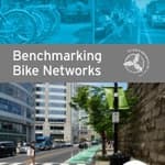
This report summarizes guidance and best practices to create safer bicycle facilities and connect them into networks that allow more people to safely bike to more places within and throughout communities.
Setting Speed Limits for Health and Safety
posted Apr 17, 2024
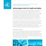
This mini-report on setting speed limits shows the current framework for speed limit policies through a review of state laws that set speed limits.
posted Nov 14, 2023
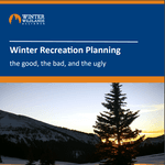
These case studies reveal a number of lessons learned that will be valuable in future winter travel management planning efforts.
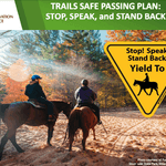
TRAILS SAFE PASSING PLAN: STOP, SPEAK, and STAND BACK
posted Feb 14, 2023
Horses are prey animals and naturally can be afraid of unfamiliar people and objects. Horses have natural "flight“ survival instincts and prefer to move their feet towards an exit route. Therefore, people with horses should pass at a walk while other trail users remain STOPPED until passed.
330 views • posted 07/28/2020