19 new National Recreation Trails in 17 states, adding more than 370 miles to the national recreation trails system of more than 1,000 trails in all 50 states.
U.S. Secretary of the Interior Ryan Zinke announced the designation of 19 new National Recreation Trails in 17 states, adding more than 370 miles to the national recreation trails system of more than 1,000 trails in all 50 states.
“By designating these new national trails, we acknowledge the efforts of local communities to provide outdoor recreational opportunities that can be enjoyed by everyone,” said Secretary Zinke. “Our network of national trails provides easily accessible places to exercise and connect with nature in both urban and rural areas while boosting tourism and supporting economic opportunities across the country.”
The designations are part of the celebration of National Trails Day, June 2, 2018. Activities planned for the annual event include hikes, educational programs, bike rides, trail rehabilitation projects, festivals, paddle trips, and trail dedications.
“The network of national recreation trails offers expansive opportunities for Americans to explore the great outdoors,” said National Park Service Deputy Director Dan Smith. “As we celebrate the 50th anniversary of the National Trails System, I hope everyone will take advantage of a nearby national trail to hike or bike.”
The National Recreation Trails Program is jointly administered by the National Park Service and the U.S. Forest Service, in conjunction with a number of Federal and not-for-profit partners, notably American Trails, which hosts the National Recreation Trails website.
California
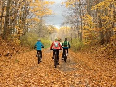
The Mt. Umunhum Trail offers 3.7 miles of moderate terrain to hikers, bicyclists, and equestrians as it passes through chaparral, pine and oak woodlands, over the headwaters of Guadalupe Creek, and climbs to one of the few publicly accessible peaks in the Bay Area. Views reveal the valley below, ridgelines, and nearby peaks. The trail emerges near the rocky summit where rare plants, lizards, birds, butterflies, and 360-degree vistas can be seen.
In the City of Jacksonville’s Kathryn Abbey Hanna Park, 20.85 miles of hiking and biking trails provide a variety of experiences for all skill levels: from easy hiking and biking on the 1.1-mile Service Road, to hiking the 6.0-mile Wellness Trail, to biking the very difficult 3.9-mile off-road Z-Trail. The trail system provides access to the shoreline, the extensive dune system, and maritime hammocks.
On the grounds of Fort Larned National Historic Site, this 1.1-mile loop trail highlights history and nature. Fort Larned is located on the historic Santa Fe Trail and on the Central Flyway, a major bird migration corridor. There are fifteen stops along the trail corresponding to detailed information in the trail guide. A variety of habitats provide opportunities to view numerous species of birds.
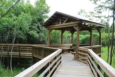
Designed and constructed through the teamwork of multiple youth, community, and Refuge partners, the 1.1-mile Fort River Birding and Nature Trail is located in Hadley at the Fort River Division of the Silvio O. Conte National Fish and Wildlife Refuge. The trail is universally accessible and functions as an outdoor visitor center, connecting people to nature by immersing them in diverse habitats from grasslands, riparian areas, and upland forests.
The Iron Ore Heritage Trail is a 47-mile, multi-use, year-round trail that connects the sites and stories of the Marquette Iron Range, a significant historical area where iron mines operated to serve the country during the Civil War, the Industrial Revolution, World War I, and World War II. The rail-trail connects Marquette to Republic in the Upper Peninsula of Michigan.
The 32 miles of the North Western State Trail connect the resort communities of Petoskey, Harbor Springs, Alanson, Pellston, and Mackinaw City in northern Michigan. Most of the universally accessible trail is located on the former Grand Rapids and Indiana line of the Pennsylvania Railroad. It is open year round to non-motorized users and to snowmobilers in winter.
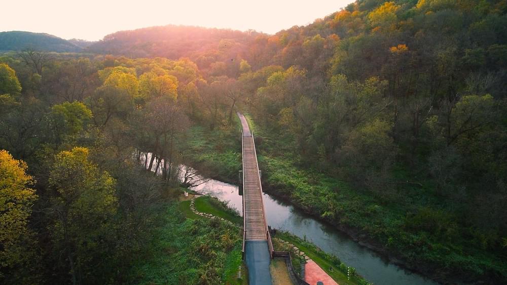
Paralleling the Cannon River, this 19.7-mile trail runs through diverse and spectacular scenery on a former Chicago Great Western Railroad line connecting the cities of Cannon Falls, Welch, and Red Wing in southeastern Minnesota. The trail is open in all seasons for bicycling, in-line skating, skateboarding, hiking, walking, and cross-country skiing.
The 5-mile Wilson’s Creek Greenway is the newest extension of a growing urban trail network in Springfield that is powered by a long list of diverse partners. The trail is a vital connection between neighborhoods, schools, businesses, and shopping areas; it plays a role in boosting social interaction, community pride, and mental health. People of all ages and abilities can access the woods and pastureland of the Ozarks for active transportation, bicycling, walking, running, skating, and wheelchair use.
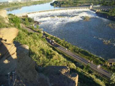
The 53 miles of the River's Edge Trail in Great Falls is the perfect venue for biking, jogging, inline skating, running, and walking. Nineteen miles of fully accessible paved urban trails link many local parks and attractions along both sides of the scenic Missouri River. Connecting to the urban trails are over thirty miles of natural trails on the South Shore and North Shore for the best mountain biking and hiking in the region.
This easy to moderate 3-mile, figure 8 loop trail overlooking downtown Raton is named after the now abandoned Climax Mine. Schools use the trail as a field trip location to teach students about ecology, biology, geology, and natural science. With its historic significance and fantastic views of mountains, mesas, and New Mexico's high plains, the trail is one of Raton’s outdoor recreation treasures.
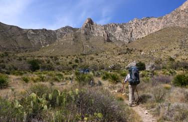
Starting in Guadalupe Mountains National Park, 100 miles of trail traverses the rocky peaks of the highest point in Texas (Guadalupe Peak), Chihuahuan Desert terrain, mixed coniferous forests, riparian woodlands, and rocky canyons. The trail continues through the landscapes of the Lincoln National Forest. An optional loop includes Last Chance Canyon and the desert oasis of Sitting Bull Falls. The trail then crosses Carlsbad Caverns National Park and Bureau of Land Management property, with stunning views of the rugged Guadalupe Ridge. The trail ends in White’s City, New Mexico. The trail in places can include use by equestrian and stock, motorized vehicles, and bikes.
This 3.7-mile system of trails is on 70 acres of land across from the Martin Van Buren National Historic Site. The trails are ideal for hiking, walking, families, dog walkers, environmental education, and youth activities. Features include meadow, stream, marsh, forest, farm, rolling hills, and historic right of way.
Named for a local conservationist, the Jim Mayer Riverswalk Trail is a 3.1-mile urban rail-trail on the east end of the City of Johnstown. The trail offers views of the Stonycreek River, abundant bird-life and wildflowers, picturesque Buttermilk Falls, and serenity within an urban setting. As part of the local vision to make recreational trail use more accessible in the Greater Johnstown area, the trail provides opportunities for wellness, enhanced recreational experiences, and connections to other trail systems.
The Blackberry Trail is located entirely within Mount Rushmore National Memorial. This one-mile gravel trail connects with the Centennial Trail in the Black Elk Wilderness, a part of the Black Hills National Forest. Mainly used by equestrians as a spur trail to access Mount Rushmore, visitors have the opportunity to ride or hike in solitude, enjoying the trees, birds, and geology.
Rising above the City of Kingsport, Bays Mountain Park and Planetarium features roughly 40 miles of trails suitable for all levels of hiking and mountain biking expertise. From scenic, fun, single-track trails to old service roads leading to the ridgetop fire tower, 31 named trails provide a great escape to the natural world.
Texas
The Salado Creek Greenway is a 15-mile scenic multi-use trail along Salado Creek within the northern part of the City of San Antonio. It has brought together people from all walks of life to share in health, recreation, wellness, and community. The trail connects the natural environment with the people who live near it and enhances the quality of recreation for the surrounding neighborhoods.
Utah
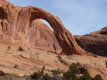
This trail on Bureau of Land Management land leads to Corona Arch’s impressive 140 by 105-foot opening and the adjacent Bow Tie Arch. Approximately 14 driving miles from Moab, the 1.5-mile out-and-back trail provides visitors with striking views of the Colorado River and a large slickrock canyon.
This 7.2-mile network of paths and old logging roads provides recreational access to the forest land and wildlife habitat of Wright's Mountain, Bradford's highest peak. At the summit visitors enjoy a wonderful view in all seasons of the Waits River Valley. The pedestrian trails were constructed and are maintained by volunteers.
The Dahlgren Railroad Heritage Trail is a 15.7-mile converted
rails-to-trail located in King George County. The beautiful corridor
with its continuous gravel and stone dust surface serves walkers,
runners, and bikers. The trail is an official part of the Potomac
Heritage National Scenic Trail.
Each of the newly designated trails will receive a certificate of designation, a set of trail markers, and a letter of congratulations recognition from Secretary Zinke.
National Recreation Trail designation recognizes existing trails and trail systems that link communities to recreational opportunities on public lands and in local parks across the nation. Each of the new National Recreation Trails will receive a certificate of designation, a letter of congratulations from the Secretary of Interior or Secretary of Agriculture, and a set of trail markers.
The National Recreation Trails program is jointly administered by the National Park Service and the U.S. Forest Service in conjunction with a number of other federal and nonprofit partners, notably American Trails, which hosts the National Recreation Trails website and National Recreation Trail Database.
View these new NRTs and more than 1,200 more in the NRT Database
Explore over 1,200 trails that make up the NRT system.
Learn how to apply for NRT Designation
Is your trail a good candidate for National Recreation Trail designation? This page will tell you the requirements and how to nominate your trail.
1,284 views • posted 06/04/2018