
Community Linkage
Prison Hill Recreation Area
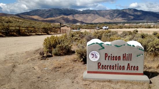
The Prison Hill Recreation Area – 5th Street Trailhead and Trails Project was conceived to re-create an area of about 60 acres on the north end of Prison Hill in order to make it an attractive, sustainable, accessible, family-friendly, and inclusive recreation area.
The Prison Hill Recreation Area consists of about 2,500 acres and is part of more than 5,000 contiguous acres of land in the Carson River corridor that are managed by Carson City as Parks and Open Space. The east and north sides of Prison Hill are adjacent to some of Carson City’s largest residential populations.
The Prison Hill Recreation Area was conveyed to Carson City from the Bureau of Land Management (BLM) in 2015 as part of a Federal Lands Bill. Prior to the conveyance the BLM closed the north end of Prison Hill to motorized vehicles, but years of unregulated travel left numerous user-created roads and trails, many of them highly erosive and visually unattractive. It should be noted that the south end of Prison Hill remains open to motorized recreation, and that area is being developed for OHV opportunities, in part with the help of another RTP grant.
The Prison Hill Recreation Area – 5th Street Trailhead and Trails Project was conceived to re-create an area of about 60 acres on the north end of Prison Hill in order to make it an attractive, sustainable, accessible, family-friendly, and inclusive recreation area. We believe we achieved that goal and we are very proud of the result. Many residents have told us that they used to avoid this area because of challenging accessibility and unsavory activities. It is now a very popular trailhead that serves as a centralized location for access to numerous trails – paved, double-track, and single-track -- that make connections throughout our community. Match for the project came from Carson City’s Quality of Life Initiative.
Listed below are the achievements of our project:
- This project created a centralized location for access to a system of over 30 miles of trails and pathways, many of which are ADA compliant. These trails provide connections to the Carson River, adjacent neighborhoods, 5000 acres Parks and Open Space, and our downtown core.
- A trail counter placed at this trailhead is collecting over 4,000 counts per month.
- The parking area and new trails have been used by Carson High School to host a cross-country running event, and they are used regularly by both Carson High School and Eagle Valley Middle School for cross-country training.
- Muscle Powered, a local non-profit, recently used this new trailhead for their annual Bike Month celebration. They hosted a bike ride named “Choose Your Cruise”, where participants could choose from three different rides -- one on paved pathways, one on dirt trails, and one that was a combination – all accessible from this single trailhead.
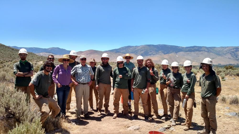
- The new facilities are used frequently by the Parks, Recreation & Open Space Department to host interpretive programs and hikes, including regular full-moon hikes.
- Four interpretive signs were placed along the new trails to highlight local flora and to identify and discuss sights visible at a viewpoint.
More winners of this award
2023: Capital to Tahoe Trail
2020: Gwinnett Countywide Trails Master Plan
2019: Ramanessin Brook Greenway Trails
2018: Drake Harbor Recreation Area - Missouri
2017: Black River Falls Motorized Access Trail - Wisconsin